Cof Cymru: National Historic Assets of Wales · Wales
Quay Walls
Cardigan, Ceredigion, Wales
A Grade II listed building in Cambrian Quay, Cardigan, Ceredigion, designated on 18 April 2006.
The record
- Designation
- Listed building, Grade II
- Broad class
- Maritime
- Date of designation
- 18 April 2006
- Locality
- Cambrian Quay
- Town
- Cardigan
- Community
- Cardigan
- Unitary authority
- Ceredigion
- Country
- Wales
- Coordinates
- 52.08170, -4.66372
- Cadw reference
- 87485
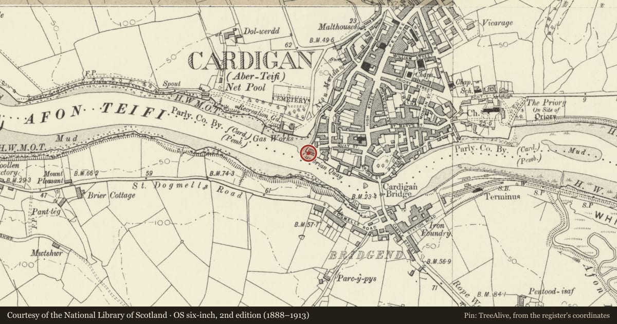
Slide toward Today to fade the historical sheet and see the modern map underneath.
David Rumsey Map Collection, Stanford LibrariesDavid Rumsey Map Collection, Stanford LibrariesDavid Rumsey Map Collection, Stanford LibrariesDavid Rumsey Map Collection, Stanford LibrariesDavid Rumsey Map Collection, Stanford Libraries
5 historical maps cover this location, the earliest the 1608 map "(13) Cambriae Typus." (David Rumsey Map Collection, Stanford Libraries).
Historical maps covering this location
- 1608 · (13) Cambriae Typus. (David Rumsey Map Collection, Stanford Libraries)
- 1637 · Particular description of Wales. Cambria seu Wallia (David Rumsey Map Collection, Stanford Libraries)
- 1830 · V.3:11-15:XV. Britisches Reich. A. Kon: England. b. Frstenthum Wales: Shire: 37-40 (David Rumsey Map Collection, Stanford Libraries)
- 1898 · 193 Cardigan (Hills) (David Rumsey Map Collection, Stanford Libraries)
- 1901 · Sheet 13. (David Rumsey Map Collection, Stanford Libraries)
Cadw's description
Location
The walls form the SE side of a slipway at the W end of Cambrian Quay, and thence run SE for a distance of some 60m alongside the river to the projecting section of a further quay. The slipway is accessed from the carpark at the end of Quay Street.
History
The quay walls are probably c1810-1820, and are shown on Wood's map of the town of 1834. With surviving warehouses close to the river, they are an important reminder of the significance of maritime trade in the growth and development of Cardigan, especially during the C19. The port had been ranked ninth amongst the leading ports handling coastal trade of England and Wales (excluding London) in 1775-1780, and in 1835, 291 ships belonged to the port. Imports included timber from North America and Norway, coal and culm, manufactured goods, whilst agricultural produce dominated the export trade. The port maintained a role in maritime trade until the arrival of the railway in the later C19, and the subsequent silting up of the estuary.
Exterior
Quay walls. Built of dressed narrow blocks of local stone and capped with big slabs. In plan, the walls curve round the angle of slipway and main river frontage, and there is a further curved offset alongside the slipway, where there is also a flight of steps alongside the wall.
Reason for designation
Listed as a well preserved section of early C19 wharf walls, which are a fine example of their type, and which are of historic interest as indicating the importance of coastal trade to the economy of Cardigan.
Nearby in the register
- 16 Quay StreetDomesticunder 1 mi
- 4 Rook Terrace including Forecourt Walls Railings & GatesDomesticunder 1 mi
- 17 Quay StreetDomesticunder 1 mi
- 3 Rook Terrace including Forecourt Walls Railings & GatesDomesticunder 1 mi
Other entries of the same register within about three miles of this one, by straight line.