Cof Cymru: National Historic Assets of Wales · Wales
Island Quay (Cei Ynys)
Conwy, Conwy, Wales
A Grade II listed building in Afon Conwy, Conwy, designated on 30 December 2005.
The record
- Designation
- Listed building, Grade II
- Broad class
- No class recorded
- Date of designation
- 30 December 2005
- Locality
- Afon Conwy
- Town
- Conwy
- Community
- Conwy
- Unitary authority
- Conwy
- Country
- Wales
- Coordinates
- 53.28035, -3.82213
- Cadw reference
- 87425
Slide toward Today to fade the historical sheet and see the modern map underneath.
David Rumsey Map Collection, Stanford LibrariesDavid Rumsey Map Collection, Stanford LibrariesDavid Rumsey Map Collection, Stanford LibrariesLlyfrgell Genedlaethol Cymru – The National Library of WalesDavid Rumsey Map Collection, Stanford Libraries
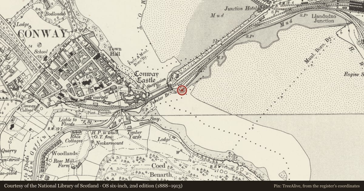
5 historical maps cover this location, the earliest the 1795 map "To Sir Watkin Williams-Wynn Bart ... the map of the six counties of North Wales is most humbly inscribed by his obedient humble servant" (Llyfrgell Genedlaethol Cymru – The National Library of Wales).
Historical maps covering this location
- 1795 · To Sir Watkin Williams-Wynn Bart ... the map of the six counties of North Wales is most… (Llyfrgell Genedlaethol Cymru – The National Library of Wales)
- 1830 · V.3:11-15:XV. Britisches Reich. A. Kon: England. b. Frstenthum Wales: Shire: 37-40 (David Rumsey Map Collection, Stanford Libraries)
- 1883 · Watershed map England, Wales 3. (David Rumsey Map Collection, Stanford Libraries)
- 1899 · 94 Beaumaris (Hills) (David Rumsey Map Collection, Stanford Libraries)
- 1901 · Sheet 9 and 10. (David Rumsey Map Collection, Stanford Libraries)
Cadw's description
Location
Immediately SE of the Tubular bridge on the R bank of Afon Conwy.
History
A small quay served by 2 sidings on the Chester & Holyhead Railway. The line to the quay was brought into use in 1852, enabling slate, fish etc. from the Conwy Valley for transhipment to the railway. The track to the quay was used as storage sidings after opening of the line to Betws y Coed. The quay is shown with crane on the 1890 Ordnance Survey.
Exterior
An L-shaped quay of rubble-stone, approximately 35m NW-SE by 75m NE-SW. The quayside retains one iron mooring post and a cast-iron crane.
Reason for designation
Listed for its special interest as a surviving C19 wharf relating to river and rail transport, and for its contribution to the historical integrity of bridges and associated features spanning the Afon Conwy.
Nearby in the register
- Toll house at Conwy Suspension BridgeRecreationalunder 1 mi
- Tubular Railway BridgeTransportunder 1 mi
- Conwy Suspension BridgeTransportunder 1 mi
- Retaining wall of Afon Gyffin to E of Pont PensarnDomesticunder 1 mi
Other entries of the same register within about three miles of this one, by straight line.