Cof Cymru: National Historic Assets of Wales · Wales
Cadnant Bridge
Conwy, Conwy, Wales
A Grade II listed building in Cadnant Park, Conwy, designated on 30 December 2005.
The record
- Designation
- Listed building, Grade II
- Broad class
- No class recorded
- Date of designation
- 30 December 2005
- Locality
- Cadnant Park
- Town
- Conwy
- Community
- Conwy
- Unitary authority
- Conwy
- Country
- Wales
- Coordinates
- 53.28218, -3.83397
- Cadw reference
- 87417
Slide toward Today to fade the historical sheet and see the modern map underneath.
David Rumsey Map Collection, Stanford LibrariesDavid Rumsey Map Collection, Stanford LibrariesDavid Rumsey Map Collection, Stanford LibrariesLlyfrgell Genedlaethol Cymru – The National Library of WalesDavid Rumsey Map Collection, Stanford Libraries
5 historical maps cover this location, the earliest the 1795 map "To Sir Watkin Williams-Wynn Bart ... the map of the six counties of North Wales is most humbly inscribed by his obedient humble servant" (Llyfrgell Genedlaethol Cymru – The National Library of Wales).
Historical maps covering this location
- 1795 · To Sir Watkin Williams-Wynn Bart ... the map of the six counties of North Wales is most… (Llyfrgell Genedlaethol Cymru – The National Library of Wales)
- 1830 · V.3:11-15:XV. Britisches Reich. A. Kon: England. b. Frstenthum Wales: Shire: 37-40 (David Rumsey Map Collection, Stanford Libraries)
- 1883 · Watershed map England, Wales 3. (David Rumsey Map Collection, Stanford Libraries)
- 1899 · 94 Beaumaris (Hills) (David Rumsey Map Collection, Stanford Libraries)
- 1901 · Sheet 9 and 10. (David Rumsey Map Collection, Stanford Libraries)
Cadw's description
Location
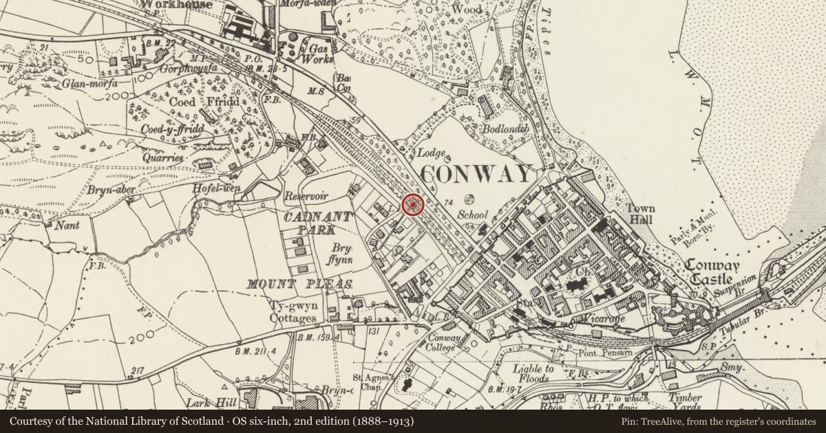
To the SW of Bangor Road, spanning the railway.
History
Built in the late C19 to connect new Cadnant Park suburban housing to Bangor Road, and shown on the 1889 Ordnance Survey.
Exterior
A single carriageway 3-bay viaduct over a deep railway cutting, of rubble stone with tooled dressings. It has tall piers with continuous chamfers to round arches. Above the central arch is a blank shield in each face. The parapet has round-backed tooled copings and is raised above the central arch. Terminal piers (partly overgrown at the time of survey) are rectangular, and the copings have been removed. Rubble-stone walls are attached at each end.
Reason for designation
Listed as a fine C19 road bridge of distinctive character, and for its historical interest as part of the late C19 suburban development of Conwy.
Nearby in the register
- Bodlondeb LodgeDomesticunder 1 mi
- 2 Bryn FfynnonNo class recordedunder 1 mi
- 1 Bryn FfynnonDomesticunder 1 mi
- Castlebank HotelDomesticunder 1 mi
Other entries of the same register within about three miles of this one, by straight line.