Cof Cymru: National Historic Assets of Wales · Wales
Hodesdon
Conwy, Conwy, Wales
A Grade II listed building in Walled town, Conwy, designated on 30 December 2005.
The record
- Designation
- Listed building, Grade II
- Broad class
- No class recorded
- Date of designation
- 30 December 2005
- Locality
- Walled town
- Town
- Conwy
- Community
- Conwy
- Unitary authority
- Conwy
- Country
- Wales
- Coordinates
- 53.28033, -3.82735
- Cadw reference
- 87403
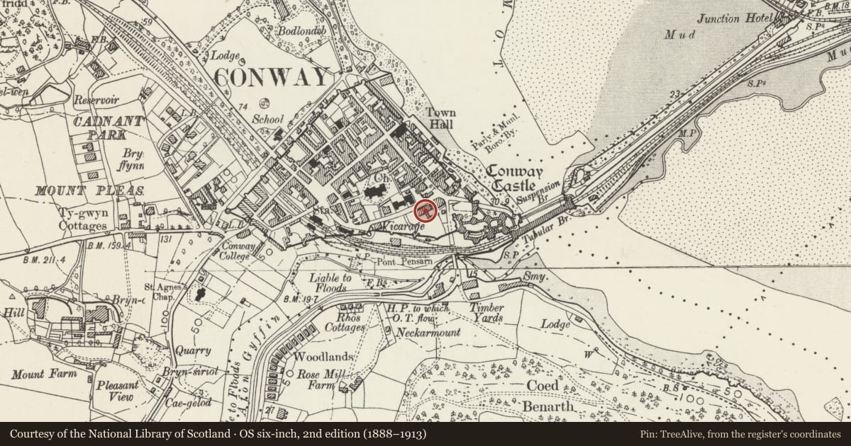
Slide toward Today to fade the historical sheet and see the modern map underneath.
David Rumsey Map Collection, Stanford LibrariesDavid Rumsey Map Collection, Stanford LibrariesDavid Rumsey Map Collection, Stanford LibrariesLlyfrgell Genedlaethol Cymru – The National Library of WalesDavid Rumsey Map Collection, Stanford Libraries
5 historical maps cover this location, the earliest the 1795 map "To Sir Watkin Williams-Wynn Bart ... the map of the six counties of North Wales is most humbly inscribed by his obedient humble servant" (Llyfrgell Genedlaethol Cymru – The National Library of Wales).
Historical maps covering this location
- 1795 · To Sir Watkin Williams-Wynn Bart ... the map of the six counties of North Wales is most… (Llyfrgell Genedlaethol Cymru – The National Library of Wales)
- 1830 · V.3:11-15:XV. Britisches Reich. A. Kon: England. b. Frstenthum Wales: Shire: 37-40 (David Rumsey Map Collection, Stanford Libraries)
- 1883 · Watershed map England, Wales 3. (David Rumsey Map Collection, Stanford Libraries)
- 1899 · 94 Beaumaris (Hills) (David Rumsey Map Collection, Stanford Libraries)
- 1901 · Sheet 9 and 10. (David Rumsey Map Collection, Stanford Libraries)
Cadw's description
Location
Set back from the road and one of a group of houses W of Castle Square.
History
Late C19 or c1900 and shown on the 1913 Ordnance Survey.
Exterior
A 3-storey 2-bay house of roughcast painted cream, with white smooth-rendered quoins, banding and window surrounds, slate roof and end brick stacks. Openings are offset to the L. The entrance is on the L side and has a panel door and overlight, under a corbelled entablature and pediment. On the R side is a 2-storey canted bay window with 2-pane sashes. A cambered 2-pane sash window in an architrave is above the entrance. The upper storey has 4-pane sash windows, of which the R-hand is larger, has a cambered head and is beneath a gable with finial.
The rear has 4-pane sash windows on the L side, a 1-storey projection and inserted windows on the R side.
Interior
Not inspected.
Reason for designation
Listed as a well-preserved late C19 town house near the centre of the town, forming a strong visual group with Nos 5 and 9-11.
Nearby in the register
- Fron Deg, including forecourt steps and railingsDomesticunder 1 mi
- Isgraig (Christopher Gash Dental Surgery)No class recordedunder 1 mi
- Meddiant, including forecourt steps and railingsNo class recordedunder 1 mi
- The Bridge public houseCommercialunder 1 mi
Other entries of the same register within about three miles of this one, by straight line.