Cof Cymru: National Historic Assets of Wales · Wales
War Memorial
Ruthin, Denbighshire, Wales
A Grade II listed building in Market Street & Wynnstay Road, Ruthin, Denbighshire, designated on 30 December 2005.
The record
- Designation
- Listed building, Grade II
- Broad class
- No class recorded
- Date of designation
- 30 December 2005
- Locality
- Market Street & Wynnstay Road
- Town
- Ruthin
- Community
- Ruthin
- Unitary authority
- Denbighshire
- Country
- Wales
- Coordinates
- 53.11470, -3.30868
- Cadw reference
- 87355
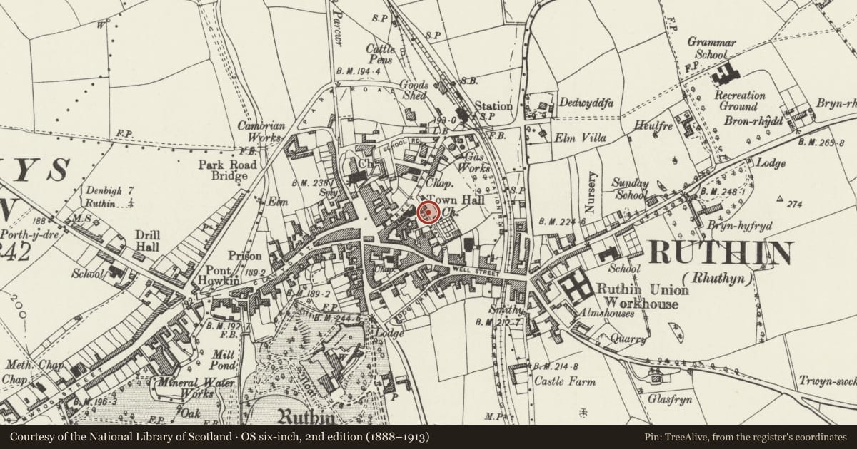
Slide toward Today to fade the historical sheet and see the modern map underneath.
David Rumsey Map Collection, Stanford LibrariesDavid Rumsey Map Collection, Stanford LibrariesDavid Rumsey Map Collection, Stanford LibrariesLlyfrgell Genedlaethol Cymru – The National Library of WalesDavid Rumsey Map Collection, Stanford Libraries
5 historical maps cover this location, the earliest the 1795 map "To Sir Watkin Williams-Wynn Bart ... the map of the six counties of North Wales is most humbly inscribed by his obedient humble servant" (Llyfrgell Genedlaethol Cymru – The National Library of Wales).
Historical maps covering this location
- 1795 · To Sir Watkin Williams-Wynn Bart ... the map of the six counties of North Wales is most… (Llyfrgell Genedlaethol Cymru – The National Library of Wales)
- 1883 · Watershed map England, Wales 3. (David Rumsey Map Collection, Stanford Libraries)
- 1898 · 108 Flint (Hills) (David Rumsey Map Collection, Stanford Libraries)
- 1898 · 108 Flint (Outline) (David Rumsey Map Collection, Stanford Libraries)
- 1901 · Sheet 9 and 10. (David Rumsey Map Collection, Stanford Libraries)
Cadw's description
Location
Set back on the pavement on Wynnstay Road, with Denbighshire County Council offices immediately to the NE.
History
Built c1920. The monument was originally surrounded by iron railings, with fine views of the Clwydian Hills to the rear. The rear railings were replaced by a stone wall later, when buildings blocked the view.
Exterior
Celtic-cross style monument constructed of grey concrete resembling unpolished granite: tapering pillar surmounted by a wheel-cross decorated with inter-lace work, on a base with curved sides and stepped top moulding. The upper part of the pillar contains a blind arch with ropework surround, bearing a figure of St Michael in relief, and reading 'St Michael' below. The lower part of the pillar has an inverted dagger in relief, and interlace work; there is an inscription to each side reading: 'To the glory of God and in memory of those from this borough who fell in the war 1914-18, their name liveth forever more'. The base bears the names of the men who died. It is on a low square plinth with rounded corners which has an inscription across the front.
The monument is set within an enclosure bound by iron railings to the front and sides, and a curved stone wall to the rear. The cast iron railings have heavy plain uprights and additional rails beneath top rail and above bottom rail; square newel posts with domed finials; the rails are dentilled where they pass round the newel posts; single gates to N and S sides. The railings are on a low pecked stone plinth. Curved wall to rear, of snecked red sandstone with square end piers. Set into the wall are 3 granite tablets, those to L and R dedicated to those who died in World War II (1939-45); that to centre is to a soldier who died in the Falklands Campaign, 1982. Slate floor within enclosure.
Reason for designation
Listed for its social-historic interest as a World War I memorial, well-preserved and with unusual detail.
Nearby in the register
- Town Hall & Market HallCivilunder 1 mi
- Crown HouseCommercialunder 1 mi
- Crown CottageDomesticunder 1 mi
- 9 Well StreetNo class recordedunder 1 mi
Other entries of the same register within about three miles of this one, by straight line.