Cof Cymru: National Historic Assets of Wales · Wales
Pont y Wern (partly in Llanbedr Dyffryn Clwyd community)
Ruthin, Denbighshire, Wales
A Grade II listed building in Ruthin Rural, Ruthin, Denbighshire, designated on 24 June 1999.
The record
- Designation
- Listed building, Grade II
- Broad class
- Transport
- Date of designation
- 24 June 1999
- Locality
- Ruthin Rural
- Town
- Ruthin
- Community
- Ruthin
- Unitary authority
- Denbighshire
- Country
- Wales
- Coordinates
- 53.12960, -3.30169
- Cadw reference
- 87342
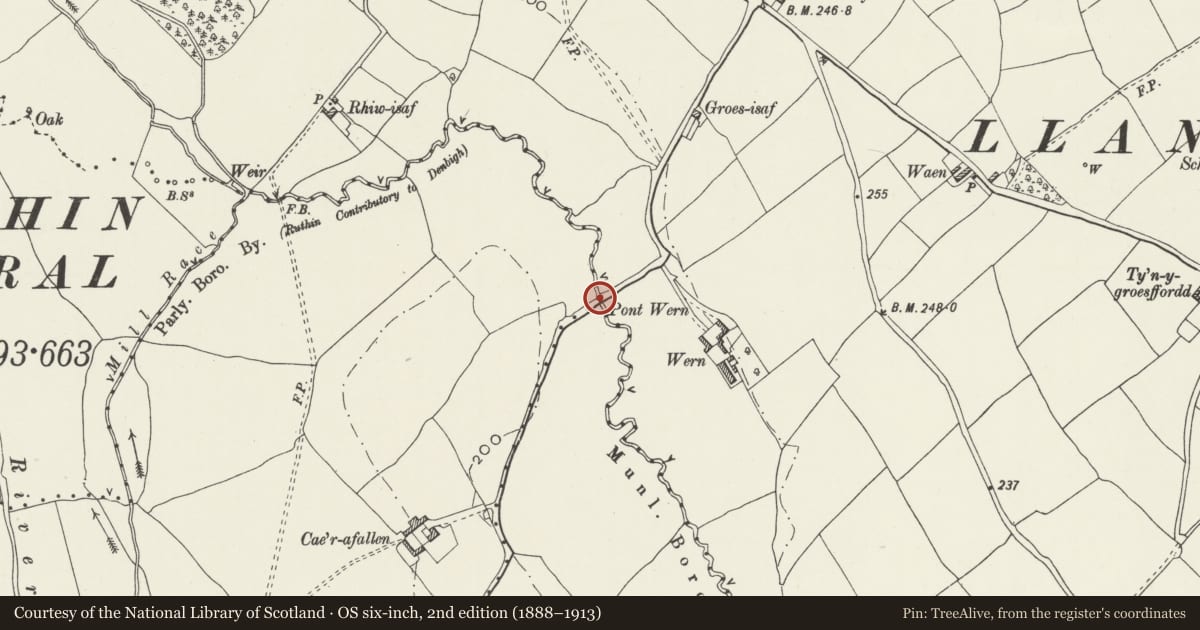
Slide toward Today to fade the historical sheet and see the modern map underneath.
David Rumsey Map Collection, Stanford LibrariesDavid Rumsey Map Collection, Stanford LibrariesDavid Rumsey Map Collection, Stanford LibrariesLlyfrgell Genedlaethol Cymru – The National Library of WalesDavid Rumsey Map Collection, Stanford Libraries
5 historical maps cover this location, the earliest the 1795 map "To Sir Watkin Williams-Wynn Bart ... the map of the six counties of North Wales is most humbly inscribed by his obedient humble servant" (Llyfrgell Genedlaethol Cymru – The National Library of Wales).
Historical maps covering this location
- 1795 · To Sir Watkin Williams-Wynn Bart ... the map of the six counties of North Wales is most… (Llyfrgell Genedlaethol Cymru – The National Library of Wales)
- 1883 · Watershed map England, Wales 3. (David Rumsey Map Collection, Stanford Libraries)
- 1898 · 108 Flint (Hills) (David Rumsey Map Collection, Stanford Libraries)
- 1898 · 108 Flint (Outline) (David Rumsey Map Collection, Stanford Libraries)
- 1901 · Sheet 9 and 10. (David Rumsey Map Collection, Stanford Libraries)
Cadw's description
Location
Spanning the Dwr Lal at the boundary with Llanbedr Dyffryn Clwyd community and carrying an unclassified lane Northwards towards Hirwaen.
History
Late C18 road bridge in largely unaltered condition.Late C18 road bridge in largely unaltered condition.
Exterior
Single-span regional road bridge of local limestone rubble construction. Segmental arch with rough-dressed voussoirs slightly recessed below archrings of narrow stones. The carriageway has a pronounced hump to the centre and the rubble parapets follow its incline. These are splayed out at the approaches and terminate in square piers; sandstone slab-copings with metal ties and various incised graffiti (the earliest date being 1880).
Reason for designation
Listed as a good example of an C18 regional road bridge.
Nearby in the register
- Pont-y-Wern (partly in Ruthin community)Transportunder 1 mi
- Caer'afallenDomesticunder 1 mi
- Multi-purpose farm building, N side of farmyard, Caer'afallenNo class recordedunder 1 mi
- L-shaped farm ranges, S & W sides of farmyard, Caer'afallenNo class recordedunder 1 mi
Other entries of the same register within about three miles of this one, by straight line.