Cof Cymru: National Historic Assets of Wales · Wales
Farm building including Cart-shed, N side of farmyard, Ffynogion
Ruthin, Denbighshire, Wales
A Grade II listed building in Ruthin Rural, Ruthin, Denbighshire, designated on 30 December 2005.
The record
- Designation
- Listed building, Grade II
- Broad class
- No class recorded
- Date of designation
- 30 December 2005
- Locality
- Ruthin Rural
- Town
- Ruthin
- Community
- Ruthin
- Unitary authority
- Denbighshire
- Country
- Wales
- Coordinates
- 53.09522, -3.30009
- Cadw reference
- 87327
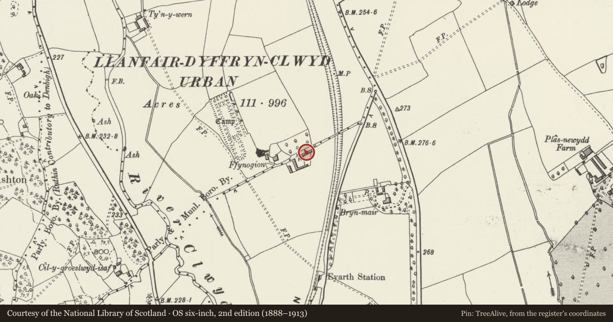
Slide toward Today to fade the historical sheet and see the modern map underneath.
David Rumsey Map Collection, Stanford LibrariesLlyfrgell Genedlaethol Cymru – The National Library of WalesDavid Rumsey Map Collection, Stanford LibrariesDavid Rumsey Map Collection, Stanford LibrariesDavid Rumsey Map Collection, Stanford Libraries
5 historical maps cover this location, the earliest the 1608 map "(13) Cambriae Typus." (David Rumsey Map Collection, Stanford Libraries).
Historical maps covering this location
- 1608 · (13) Cambriae Typus. (David Rumsey Map Collection, Stanford Libraries)
- 1795 · To Sir Watkin Williams-Wynn Bart ... the map of the six counties of North Wales is most… (Llyfrgell Genedlaethol Cymru – The National Library of Wales)
- 1830 · V.3:11-15:XV. Britisches Reich. A. Kon: England. b. Frstenthum Wales: Shire: 37-40 (David Rumsey Map Collection, Stanford Libraries)
- 1883 · Watershed map England, Wales 3. (David Rumsey Map Collection, Stanford Libraries)
- 1901 · Sheet 9 and 10. (David Rumsey Map Collection, Stanford Libraries)
Cadw's description
Location
Ffynogion is located on a by-lane off the W side of Wrexham Road. This farm building is on the N side of the farmyard at Ffynogion, the house offset to the W.
History
Shown on the Tithe map of 1839.
Exterior
Single-storey 6-bay range, constructed of random stone under a slate roof. The front faces S into the farmyard. Two-bay stable to L, with full-height door opening to L and wooden casement window to R, the R-hand light infilled with breeze blocks. To the R is a 4-bay cart-shed, the full-height open bays divided by square stone piers. Some open lean-to sheds in front, supported on timber posts. The rear elevation has ventilation slits. The E gable end leads into a 2-bay addition, open to the N side.
Interior
Interior has light timber trusses of C19 date.
Reason for designation
Listed as a farm building retaining its agricultural character, and for group value with Ffynogion farmhouse, the former service building, and L-shaped farm range to SW, which together form a complete farm group.
Nearby in the register
- L-shaped farm ranges, FfynogionAgriculture and Subsistenceunder 1 mi
- FfynogionDomesticunder 1 mi
- Service building W of FfynogionNo class recordedunder 1 mi
- Ffynogion Moated SiteMoated Siteunder 1 mi
Other entries of the same register within about three miles of this one, by straight line.