Cof Cymru: National Historic Assets of Wales · Wales
42 Clwyd Street
Ruthin, Denbighshire, Wales
A Grade II listed building in Clwyd Street, Ruthin, Denbighshire, designated on 16 May 1978.
The record
- Designation
- Listed building, Grade II
- Broad class
- No class recorded
- Date of designation
- 16 May 1978
- Locality
- Clwyd Street
- Town
- Ruthin
- Community
- Ruthin
- Unitary authority
- Denbighshire
- Country
- Wales
- Coordinates
- 53.11370, -3.31329
- Cadw reference
- 87314
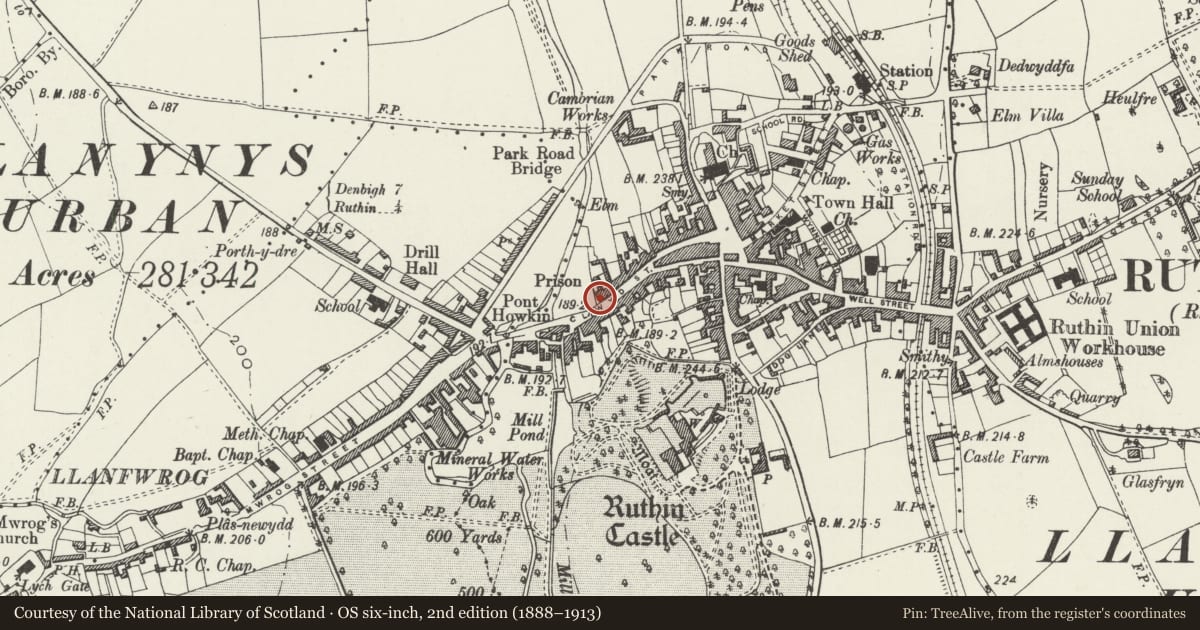
Slide toward Today to fade the historical sheet and see the modern map underneath.
David Rumsey Map Collection, Stanford LibrariesDavid Rumsey Map Collection, Stanford LibrariesLlyfrgell Genedlaethol Cymru – The National Library of WalesDavid Rumsey Map Collection, Stanford LibrariesDavid Rumsey Map Collection, Stanford Libraries
5 historical maps cover this location, the earliest the 1795 map "To Sir Watkin Williams-Wynn Bart ... the map of the six counties of North Wales is most humbly inscribed by his obedient humble servant" (Llyfrgell Genedlaethol Cymru – The National Library of Wales).
Historical maps covering this location
- 1795 · To Sir Watkin Williams-Wynn Bart ... the map of the six counties of North Wales is most… (Llyfrgell Genedlaethol Cymru – The National Library of Wales)
- 1830 · V.3:11-15:XV. Britisches Reich. A. Kon: England. b. Frstenthum Wales: Shire: 37-40 (David Rumsey Map Collection, Stanford Libraries)
- 1883 · Watershed map England, Wales 3. (David Rumsey Map Collection, Stanford Libraries)
- 1898 · 108 Flint (Hills) (David Rumsey Map Collection, Stanford Libraries)
- 1901 · Sheet 9 and 10. (David Rumsey Map Collection, Stanford Libraries)
Cadw's description
Location
Located at the bottom of Clwyd Street, immediately adjacent to the Old Gaol.
History
C17-18, the stone walls replacing timber-framing, a little of which is said to remain. Probably one house originally, with central chimney. Now 2 cottages, that to R with a shop-front.
Exterior
40 & 42 form a group.
Irregular 4-window range of one-and-a-half storeys, rendered on a plinth, under a slate roof, with large central brick ridge stack.
No 42 has inserted central entrance with late C20 wooden door containing small arched lights. Late C20 small-pane wooden windows, a large top-hung window to R of entrance, and 2 x 2-light casements to upper storey. W gable end has 2 small windows to ground floor. Rear not seen.
Interior
Interior not seen.
Reason for designation
Listed, notwithstanding alterations to openings, as a house with sub-medieval origins retaining its central-chimney plan-form. Group value with surrounding listed buildings in Clwyd Street.
Nearby in the register
- 40 Clwyd StreetCommercialunder 1 mi
- 38 Clwyd StreetNo class recordedunder 1 mi
- 36 Clwyd StreetCommercialunder 1 mi
- 39 Clwyd StreetCommercialunder 1 mi
Other entries of the same register within about three miles of this one, by straight line.