Cof Cymru: National Historic Assets of Wales · Wales
Wall, Gatepiers and Gates at Porth Pen-y-parc
Goetre Fawr, Monmouthshire, Wales
A Grade II listed building in Llanover Park, Abergavenny, Goetre Fawr, Monmouthshire, designated on 9 December 2005.
The record
- Designation
- Listed building, Grade II
- Broad class
- Domestic
- Date of designation
- 9 December 2005
- Locality
- Llanover Park
- Town
- Abergavenny
- Community
- Goetre Fawr
- Unitary authority
- Monmouthshire
- Country
- Wales
- Coordinates
- 51.77043, -3.00108
- Cadw reference
- 87212
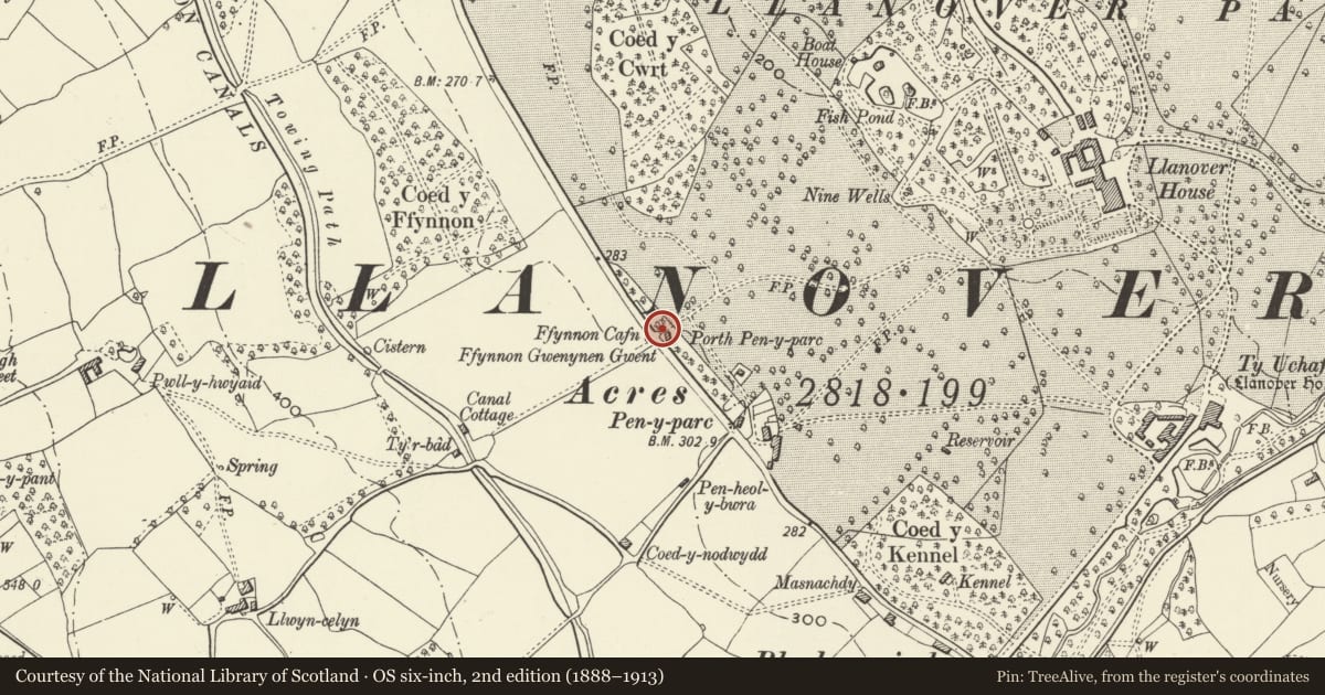
Slide toward Today to fade the historical sheet and see the modern map underneath.
David Rumsey Map Collection, Stanford LibrariesDavid Rumsey Map Collection, Stanford LibrariesDavid Rumsey Map Collection, Stanford LibrariesDavid Rumsey Map Collection, Stanford LibrariesDavid Rumsey Map Collection, Stanford Libraries
5 historical maps cover this location, the earliest the 1636 map "Cornubia : Devonia, Somersetus, Dorcestria, Wiltonia, Glocestria ..." (David Rumsey Map Collection, Stanford Libraries).
Historical maps covering this location
- 1636 · Cornubia : Devonia, Somersetus, Dorcestria, Wiltonia, Glocestria ... (David Rumsey Map Collection, Stanford Libraries)
- 1895 · Sheet 11. Ordnance Survey of England and Wales. (David Rumsey Map Collection, Stanford Libraries)
- 1898 · 232 Abergavenny (Hills) (David Rumsey Map Collection, Stanford Libraries)
- 1898 · 232 Abergavenny (Outline) (David Rumsey Map Collection, Stanford Libraries)
- 1913 · Sheet 102. Newport. (David Rumsey Map Collection, Stanford Libraries)
Cadw's description
Location
On the east side of the A4042 at the northern end of Llanover village.
History
Part of the improvements to the Llanover estate carried out before and during WWI. The gateway was formed in the existing Victorian perimeter wall to the park but the adjoining lodge (qv) is also C19 so there must have been a gate of some sort. The lodge was improved in 1916 (dated) and the gate may be contemporary.
Exterior
Squared and coursed rock faced red sandstone with dressed caps to the gatepiers, wrought iron gates. Wing walls sweep in to square gatepiers with pyramid caps. The walls are about 2m in height and are capped by a cock-and-hen coping to match the perimeter wall. Iron double gates with spike finials and dog-bars.
Reason for designation
Included for its special interest as part of the improvements to the Llanover estate carried out before and during WWI.
Nearby in the register
- Lodge at Porth Pen-y-parcDomesticunder 1 mi
- Ffynnon Gwenynen GwentWater Supply and Drainageunder 1 mi
- Ty-saer-maenDomesticunder 1 mi
- Ty-saer-coedDomesticunder 1 mi
Other entries of the same register within about three miles of this one, by straight line.