Cof Cymru: National Historic Assets of Wales · Wales
Stable Block at Ty Uchaf
Goetre Fawr, Monmouthshire, Wales
A Grade II listed building in Llanover Park, Abergavenny, Goetre Fawr, Monmouthshire, designated on 9 December 2005.
The record
- Designation
- Listed building, Grade II
- Broad class
- Domestic
- Date of designation
- 9 December 2005
- Locality
- Llanover Park
- Town
- Abergavenny
- Community
- Goetre Fawr
- Unitary authority
- Monmouthshire
- Country
- Wales
- Coordinates
- 51.76938, -2.99079
- Cadw reference
- 87192
Slide toward Today to fade the historical sheet and see the modern map underneath.
David Rumsey Map Collection, Stanford LibrariesDavid Rumsey Map Collection, Stanford LibrariesDavid Rumsey Map Collection, Stanford LibrariesDavid Rumsey Map Collection, Stanford LibrariesDavid Rumsey Map Collection, Stanford Libraries
5 historical maps cover this location, the earliest the 1636 map "Cornubia : Devonia, Somersetus, Dorcestria, Wiltonia, Glocestria ..." (David Rumsey Map Collection, Stanford Libraries).
Historical maps covering this location
- 1636 · Cornubia : Devonia, Somersetus, Dorcestria, Wiltonia, Glocestria ... (David Rumsey Map Collection, Stanford Libraries)
- 1895 · Sheet 11. Ordnance Survey of England and Wales. (David Rumsey Map Collection, Stanford Libraries)
- 1898 · 232 Abergavenny (Hills) (David Rumsey Map Collection, Stanford Libraries)
- 1898 · 232 Abergavenny (Outline) (David Rumsey Map Collection, Stanford Libraries)
- 1913 · Sheet 102. Newport. (David Rumsey Map Collection, Stanford Libraries)
Cadw's description
Location
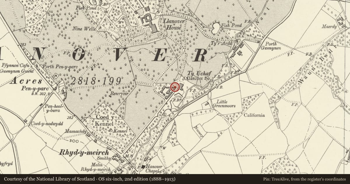
In the centre of Llanover Park on the east side of the A4042 and approached via Porth-y-pentre. It stands to the west of Ty Uchaf.
History
Probably mostly early C19 in origin but also with some character from later in the century.
Exterior
Rendered and painted, probably over rubble stone, stone slate roof. Two storey single depth range with central semi-circular arch beneath gable. Carriage house to left with paired doors with slightly pointed heads, square window above. Circular 4-pane window in central gable. To right a 3-light window with a 2-light one above. Plain gable ends to roof, the left one abuts the barn (qv). Rear elevation not seen.
Included for group value.
Interior
Interior not available at resurvey.
Reason for designation
Included for its special interest as an adjunct to a fine late C18 country house and having group value within Llanover Park.
Nearby in the register
- Barn and attached building at Ty UchafAgriculture and Subsistenceunder 1 mi
- Ty UchafDomesticunder 1 mi
- Dovecote at Ty Uchaf with flanking wallsDomesticunder 1 mi
- Old Stable Block (ruin) at Llanover ParkDomesticunder 1 mi
Other entries of the same register within about three miles of this one, by straight line.