Cof Cymru: National Historic Assets of Wales · Wales
Cross in Churchyard of Church of St. Bride
Gobion Fawr, Monmouthshire, Wales
A Grade II listed building in Llansantffraid, Abergavenny, Gobion Fawr, Monmouthshire, designated on 9 December 2005.
The record
- Designation
- Listed building, Grade II
- Broad class
- Religious, Ritual and Funerary
- Date of designation
- 9 December 2005
- Locality
- Llansantffraid
- Town
- Abergavenny
- Community
- Gobion Fawr
- Unitary authority
- Monmouthshire
- Country
- Wales
- Coordinates
- 51.78488, -2.93307
- Cadw reference
- 87148
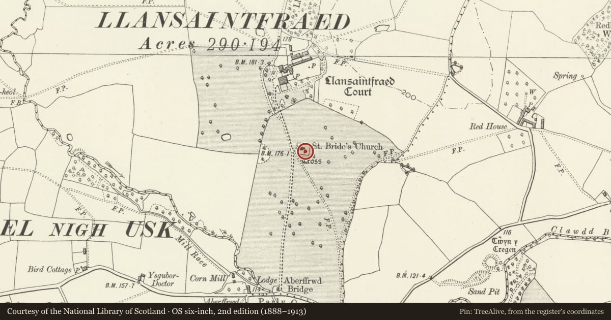
Slide toward Today to fade the historical sheet and see the modern map underneath.
David Rumsey Map Collection, Stanford LibrariesDavid Rumsey Map Collection, Stanford LibrariesDavid Rumsey Map Collection, Stanford LibrariesDavid Rumsey Map Collection, Stanford LibrariesDavid Rumsey Map Collection, Stanford Libraries
5 historical maps cover this location, the earliest the 1895 map "Sheet 11. Ordnance Survey of England and Wales." (David Rumsey Map Collection, Stanford Libraries).
Historical maps covering this location
- 1895 · Sheet 11. Ordnance Survey of England and Wales. (David Rumsey Map Collection, Stanford Libraries)
- 1898 · 232 Abergavenny (Hills) (David Rumsey Map Collection, Stanford Libraries)
- 1898 · 232 Abergavenny (Outline) (David Rumsey Map Collection, Stanford Libraries)
- 1901 · Sheet 14. (David Rumsey Map Collection, Stanford Libraries)
- 1913 · Sheet 102. Newport. (David Rumsey Map Collection, Stanford Libraries)
Cadw's description
Location
On the south side of the church.
History
Late medieval, probably late C15 churchyard cross which has lost its top and has been unrestored since. The steps are now in a very uneven state although the previously reported ivy growth has been removed.
Exterior
Built of sandstone blocks, now very unevenly fixed. Three square diminishing steps of which the bottom one has a nosing. The top step carries a shallow square base, which supports a plain socket stone and two stones of a tapered shaft with base broaches, the top is missing.
Reason for designation
Included for its special interest as a late medieval churchyard cross which, despite damage, retains significant early fabric.
Scheduled Ancient Monument: MM312(MON) - called St. Bridget's Churchyard Cross, Llansantffraed.
Nearby in the register
- St. Bridget's Churchyard Cross, LlansantffraedCrossunder 1 mi
- Church of St. BrideReligious, Ritual and Funeraryunder 1 mi
- Llansantffraid Court HotelDomesticunder 1 mi
- Twyn y Cregen Castle MoundMotteunder 1 mi
Other entries of the same register within about three miles of this one, by straight line.