Cof Cymru: National Historic Assets of Wales · Wales
No. 11 Gloucester Terrace
Haverfordwest, Pembrokeshire, Wales
A Grade II listed building in Haverfordwest, Pembrokeshire, designated on 1 July 1974.
The record
- Designation
- Listed building, Grade II
- Broad class
- Domestic
- Date of designation
- 1 July 1974
- Town
- Haverfordwest
- Community
- Haverfordwest
- Unitary authority
- Pembrokeshire
- Country
- Wales
- Coordinates
- 51.80354, -4.97098
- Cadw reference
- 87118
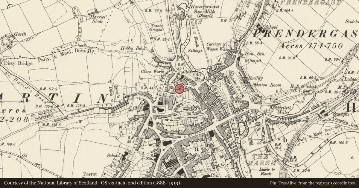
Slide toward Today to fade the historical sheet and see the modern map underneath.
David Rumsey Map Collection, Stanford LibrariesDavid Rumsey Map Collection, Stanford LibrariesDavid Rumsey Map Collection, Stanford LibrariesDavid Rumsey Map Collection, Stanford LibrariesDavid Rumsey Map Collection, Stanford Libraries
5 historical maps cover this location, the earliest the 1608 map "(13) Cambriae Typus." (David Rumsey Map Collection, Stanford Libraries).
Historical maps covering this location
- 1608 · (13) Cambriae Typus. (David Rumsey Map Collection, Stanford Libraries)
- 1636 · Cornubia : Devonia, Somersetus, Dorcestria, Wiltonia, Glocestria ... (David Rumsey Map Collection, Stanford Libraries)
- 1891 · Sheet 10. Ordnance Survey of England and Wales. . (David Rumsey Map Collection, Stanford Libraries)
- 1898 · 228 Haverfordwest (Hills) (David Rumsey Map Collection, Stanford Libraries)
- 1901 · Sheet 13. (David Rumsey Map Collection, Stanford Libraries)
Cadw's description
Location
Situated in terraced row on raised pavement, the third house of the terrace Nos 9-12 Gloucester Terrace.
History
One of a terrace of four houses probably mid C19, slightly later in date than Nos 1-8 adjoining. The four houses are in two mirrored pairs, stepped between. The lions head keystone is distinctive, appearing on Nos 9-12, 15-16, and on side of No 44 Bridge St.
Exterior
Terraced house, painted roughcast with slate close-eaved roof and rendered left end stack. Three storeys, one-window range with door to left (paired with door to No 12). Stucco plinth and plain raised shoulded surrounds to paired doorways and to windows of ground and first floors. Renewed horned sash windows, probably all originally small paned: widened C20 attic window, and plate-glass sashes to first and ground floors. Deeply recessed doorway to right paired with door of No 12, with one broad cemented step up to both doorways, one step within doorway, and lions head keystone. Recessed half-glazed 4-panel door.
Interior
Interior not inspected.
Nearby in the register
- No. 10 Gloucester TerraceDomesticunder 1 mi
- No. 12 Gloucester TerraceDomesticunder 1 mi
- No. 9 Gloucester TerraceDomesticunder 1 mi
- Belsize, No 13 Gloucester TerraceDomesticunder 1 mi
Other entries of the same register within about three miles of this one, by straight line.