Cof Cymru: National Historic Assets of Wales · Wales
No. 6 Castle Terrace
Haverfordwest, Pembrokeshire, Wales
A Grade II listed building in Haverfordwest, Pembrokeshire, designated on 1 July 1974.
The record
- Designation
- Listed building, Grade II
- Broad class
- Domestic
- Date of designation
- 1 July 1974
- Town
- Haverfordwest
- Community
- Haverfordwest
- Unitary authority
- Pembrokeshire
- Country
- Wales
- Coordinates
- 51.80300, -4.97166
- Cadw reference
- 87087
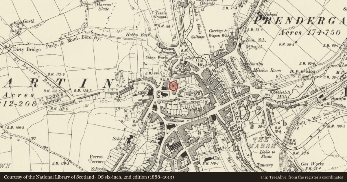
Slide toward Today to fade the historical sheet and see the modern map underneath.
David Rumsey Map Collection, Stanford LibrariesDavid Rumsey Map Collection, Stanford LibrariesDavid Rumsey Map Collection, Stanford LibrariesDavid Rumsey Map Collection, Stanford LibrariesDavid Rumsey Map Collection, Stanford Libraries
5 historical maps cover this location, the earliest the 1608 map "(13) Cambriae Typus." (David Rumsey Map Collection, Stanford Libraries).
Historical maps covering this location
- 1608 · (13) Cambriae Typus. (David Rumsey Map Collection, Stanford Libraries)
- 1636 · Cornubia : Devonia, Somersetus, Dorcestria, Wiltonia, Glocestria ... (David Rumsey Map Collection, Stanford Libraries)
- 1891 · Sheet 10. Ordnance Survey of England and Wales. . (David Rumsey Map Collection, Stanford Libraries)
- 1898 · 228 Haverfordwest (Hills) (David Rumsey Map Collection, Stanford Libraries)
- 1901 · Sheet 13. (David Rumsey Map Collection, Stanford Libraries)
Cadw's description
Location
Situated in terraced row on the E side of North Street, just N of Queen's Square.
History
Terraced house in row of seven dated 1832, possibly by William Owen of Haverfordwest.
Exterior
Terraced house, painted stucco with slate roof, deep eaves and red brick renewed end wall stacks. The eaves are flat with tiny paired modillions, facia board with top moulding. Three storeys, two-window range with arched doorway in left bay. Square 6-pane sashes to attic, 12-pane elsewhere, with stone sills, raised band over ground floor and recessed 6-panel door with two glass panels. Unusual marginal tracery to the fanlight. Basement grille under window.
Interior
Interior not inspected.
Reason for designation
Included for its special architectural interest as part of a well-preserved late Georgian style terrace.
Nearby in the register
- No. 5 Castle TerraceDomesticunder 1 mi
- No. 7 Castle TerraceDomesticunder 1 mi
- No. 4 Castle TerraceDomesticunder 1 mi
- Retaining wall, railings and pavement before Nos, 1-7 Castle TerraceDomesticunder 1 mi
Other entries of the same register within about three miles of this one, by straight line.