Cof Cymru: National Historic Assets of Wales · Wales
Stable and shippon at Sandy Lane Farm
Maelor South, Wrexham, Wales
A Grade II listed building in Sandy Lane, Maelor South, Wrexham, designated on 18 November 2005.
The record
- Designation
- Listed building, Grade II
- Broad class
- No class recorded
- Date of designation
- 18 November 2005
- Locality
- Sandy Lane
- Community
- Maelor South
- Unitary authority
- Wrexham
- Country
- Wales
- Coordinates
- 52.95595, -2.88996
- Cadw reference
- 86971
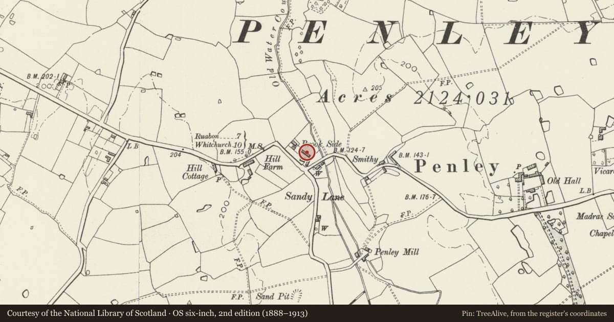
Slide toward Today to fade the historical sheet and see the modern map underneath.
David Rumsey Map Collection, Stanford LibrariesDavid Rumsey Map Collection, Stanford LibrariesDavid Rumsey Map Collection, Stanford LibrariesDavid Rumsey Map Collection, Stanford LibrariesDavid Rumsey Map Collection, Stanford Libraries
5 historical maps cover this location, the earliest the 1637 map "Particular description of Wales. Cambria seu Wallia" (David Rumsey Map Collection, Stanford Libraries).
Historical maps covering this location
- 1637 · Particular description of Wales. Cambria seu Wallia (David Rumsey Map Collection, Stanford Libraries)
- 1861 · 73. Market Drayton. (David Rumsey Map Collection, Stanford Libraries)
- 1883 · Watershed map England, Wales 3. (David Rumsey Map Collection, Stanford Libraries)
- 1897 · 122 Nantwich (Hills) (David Rumsey Map Collection, Stanford Libraries)
- 1901 · Sheet 9 and 10. (David Rumsey Map Collection, Stanford Libraries)
Cadw's description
Location
On the N side of the farmhouse, across a pitched stone farmyard.
History
A late C19 Gredington estate farm building shown on the 1900 Ordnance Survey.
Exterior
A lofted stable and shippon of brick with blue-brick segmental-headed openings, and slate roof. It has large replacement double doors, in an original opening, to the R, then a split door and window to the L. The loft has 3 openings, the R-hand open, the central retaining some original glazing bars and the L-hand with boarded shutter under a wooden lintel. A lean-to against the L gable end has a split door. Set slightly back to the R is the lower shippon. It has a split boarded door flanked by steel-framed hopper windows under lintels. Its gable end has a boarded door for the feeding passage to the R. The rear has 2 windows similar to the front and the stable has a single window on the L side.
Reason for designation
Listed as a well-preserved C19 farm building and as part of a strong farm group.
Nearby in the register
- Sandy Lane FarmhouseNo class recordedunder 1 mi
- Shippon (former barn) at Sandy Lane FarmNo class recordedunder 1 mi
- Old Hall FarmhouseDomesticunder 1 mi
- Madras Voluntary Aided SchoolNo class recordedunder 1 mi
Other entries of the same register within about three miles of this one, by straight line.