Cof Cymru: National Historic Assets of Wales · Wales
Cornhill Bridge (Bridge No 47, Llangollen Canal)
Maelor South, Wrexham, Wales
A Grade II listed building in Bettisfield, Maelor South, Wrexham, designated on 18 November 2005.
The record
- Designation
- Listed building, Grade II
- Broad class
- No class recorded
- Date of designation
- 18 November 2005
- Locality
- Bettisfield
- Community
- Maelor South
- Unitary authority
- Wrexham
- Country
- Wales
- Coordinates
- 52.91495, -2.79529
- Cadw reference
- 86962
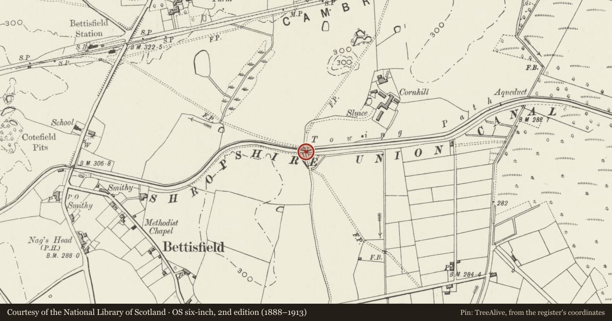
Slide toward Today to fade the historical sheet and see the modern map underneath.
David Rumsey Map Collection, Stanford LibrariesDavid Rumsey Map Collection, Stanford LibrariesDavid Rumsey Map Collection, Stanford LibrariesDavid Rumsey Map Collection, Stanford LibrariesDavid Rumsey Map Collection, Stanford Libraries
5 historical maps cover this location, the earliest the 1637 map "Particular description of Wales. Cambria seu Wallia" (David Rumsey Map Collection, Stanford Libraries).
Historical maps covering this location
- 1637 · Particular description of Wales. Cambria seu Wallia (David Rumsey Map Collection, Stanford Libraries)
- 1861 · 73. Market Drayton. (David Rumsey Map Collection, Stanford Libraries)
- 1883 · Watershed map England, Wales 3. (David Rumsey Map Collection, Stanford Libraries)
- 1899 · 138 Wem (Hills) (David Rumsey Map Collection, Stanford Libraries)
- 1901 · Sheet 9 and 10. (David Rumsey Map Collection, Stanford Libraries)
Cadw's description
Location
On farmland approximately 700m SE of Bettisfield church.
History
The Act for the Ellesmere Canal was passed in 1793, and it opened from Ellesmere Port to Llangollen, with several branches, in 1805. Its engineers were William Jessop and Thomas Telford. Telford's responsibilities included the construction of the bridges. The section between Whixall Moss and Ellesmere was completed in 1800-1, and the bridge is contemporary with it. The canal is now known as the Llangollen Canal.
Exterior
A humped-back, single-carriageway single-span brick bridge. A round brick arch spans the waterway. Abutments curve out to square terminal piers. On the SW side the abutment incorporates a round-headed iron door with strap hinges, to a deep recess for storage of stop planks. A raised band is below the parapet, which has a freestone coping. On the E side of the parapet is an oval iron plaque with '47' in raised numerals. The deck is grassed over and is used only as a public footpath.
Reason for designation
Listed as a well-preserved canal overbridge of a type characteristic of the late C18.
Nearby in the register
- Bettisfield HallDomesticunder 1 mi
- Lych gate at Church of St John the BaptistNo class recordedunder 1 mi
- Bettisfield war memorialNo class recordedunder 1 mi
- Church of St John the BaptistReligious, Ritual and Funeraryunder 1 mi
Other entries of the same register within about three miles of this one, by straight line.