Cof Cymru: National Historic Assets of Wales · Wales
West View
Hanmer, Wrexham, Wales
A Grade II listed building in Horseman's Green, Hanmer, Wrexham, designated on 15 November 2005.
The record
- Designation
- Listed building, Grade II
- Broad class
- No class recorded
- Date of designation
- 15 November 2005
- Locality
- Horseman's Green
- Community
- Hanmer
- Unitary authority
- Wrexham
- Country
- Wales
- Coordinates
- 52.96322, -2.82808
- Cadw reference
- 86955
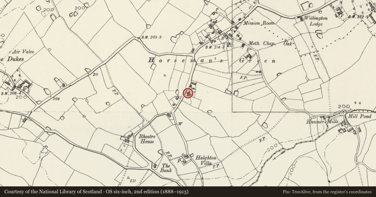
Slide toward Today to fade the historical sheet and see the modern map underneath.
David Rumsey Map Collection, Stanford LibrariesDavid Rumsey Map Collection, Stanford LibrariesDavid Rumsey Map Collection, Stanford LibrariesDavid Rumsey Map Collection, Stanford LibrariesDavid Rumsey Map Collection, Stanford Libraries
5 historical maps cover this location, the earliest the 1637 map "Particular description of Wales. Cambria seu Wallia" (David Rumsey Map Collection, Stanford Libraries).
Historical maps covering this location
- 1637 · Particular description of Wales. Cambria seu Wallia (David Rumsey Map Collection, Stanford Libraries)
- 1861 · 73. Market Drayton. (David Rumsey Map Collection, Stanford Libraries)
- 1883 · Watershed map England, Wales 3. (David Rumsey Map Collection, Stanford Libraries)
- 1897 · 122 Nantwich (Hills) (David Rumsey Map Collection, Stanford Libraries)
- 1901 · Sheet 9 and 10. (David Rumsey Map Collection, Stanford Libraries)
Cadw's description
Location
Set back on the E side of a minor road at the S end of the hamlet.
History
A C18 house, shown on the 1839 Tithe map.
Exterior
A Georgian vernacular classical house of 2½ storeys and symmetrical 3-window front. Of brick with slate roof behind coped gables on moulded kneelers, and 3 rebuilt brick stacks. The entrance is within a shallow advanced bay with open pediment. It has a fielded-panel door under a round-headed overlight, and with side lights, under a gabled canopy. Window openings are original under keyed wedge lintels, and are larger in the lower storey. All have replacement windows. The central pediment has a broken dentil cornice, keyed oculus and coped verge.
Set slightly back on the L side is a 1-storey C20 extension. The L gable end has replacement windows, including an attic window on the R side. The R gable end has replacement 2-pane sashes on the R side in each storey. Behind is a rear wing (a separate dwelling known as The Holding).
Interior
Not inspected.
Reason for designation
Listed, notwithstanding some window replacement, as a Georgian house retaining definite architectural character in a prominent location at the end of the hamlet.
Nearby in the register
- Horseman's Green FarmhouseDomesticunder 1 mi
- The DukesDomesticunder 1 mi
- Willington Lodge, including attached farm buildingsNo class recordedunder 1 mi
- The WernDomesticunder 1 mi
Other entries of the same register within about three miles of this one, by straight line.