Cof Cymru: National Historic Assets of Wales · Wales
Revetment and balustrade to forecourt and formal garden of Bettisfield Park
Hanmer, Wrexham, Wales
A Grade II listed building in Bettisfield Park, Hanmer, Wrexham, designated on 15 November 2005.
The record
- Designation
- Listed building, Grade II
- Broad class
- No class recorded
- Date of designation
- 15 November 2005
- Locality
- Bettisfield Park
- Community
- Hanmer
- Unitary authority
- Wrexham
- Country
- Wales
- Coordinates
- 52.93195, -2.80493
- Cadw reference
- 86949
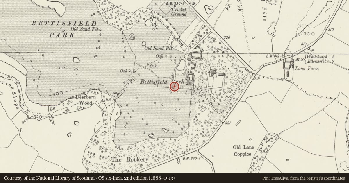
Slide toward Today to fade the historical sheet and see the modern map underneath.
David Rumsey Map Collection, Stanford LibrariesDavid Rumsey Map Collection, Stanford LibrariesDavid Rumsey Map Collection, Stanford LibrariesDavid Rumsey Map Collection, Stanford LibrariesDavid Rumsey Map Collection, Stanford Libraries
5 historical maps cover this location, the earliest the 1637 map "Particular description of Wales. Cambria seu Wallia" (David Rumsey Map Collection, Stanford Libraries).
Historical maps covering this location
- 1637 · Particular description of Wales. Cambria seu Wallia (David Rumsey Map Collection, Stanford Libraries)
- 1861 · 73. Market Drayton. (David Rumsey Map Collection, Stanford Libraries)
- 1883 · Watershed map England, Wales 3. (David Rumsey Map Collection, Stanford Libraries)
- 1897 · 122 Nantwich (Hills) (David Rumsey Map Collection, Stanford Libraries)
- 1901 · Sheet 9 and 10. (David Rumsey Map Collection, Stanford Libraries)
Cadw's description
Location
On the S and W sides of the house.
History
Bettisfield Park was the seat of the Hanmer family and is a house of at least C16 origin. A new S entrance front was built in the late C18, probably by Samuel Wyatt of London. In the mid C19 there were further additions, including an Italianate tower of the 1840s and a Tudor-style tower with French pavilion roof, and a new entrance on the E side. The revetment and balustrade belong to this mid C19 phase of enlargement and are shown on the 1873 Ordnance Survey.
Exterior
The main section is on the S side, a freestone revetment and balustrade incorporating panel piers with pyramidal caps, and open arcading. At the W end is a bowed projection, the piers of which are larger and have 4 small ball finials. The return across the W front of the house is simpler, of brick with stone coping, and brick piers with pyramid caps. It incorporates a narrow entrance. A short return at the N end has similar detail.
Reason for designation
Listed as a C19 garden feature of definite historic character, and for its contribution to the setting of the house.
Nearby in the register
- Bettisfield Park, including attached garden wallsDomesticunder 1 mi
- Water tower at Bettisfield ParkNo class recordedunder 1 mi
- The Stables at Bettisfield ParkNo class recordedunder 1 mi
- Farm Buildings at Bettisfield Park Home FarmNo class recordedunder 1 mi
Other entries of the same register within about three miles of this one, by straight line.