Cof Cymru: National Historic Assets of Wales · Wales
Hanmer war memorial
Hanmer, Wrexham, Wales
A Grade II* listed building in Hanmer, Wrexham, designated on 15 November 2005.
The record
- Designation
- Listed building, Grade II*
- Broad class
- No class recorded
- Date of designation
- 15 November 2005
- Locality
- Hanmer
- Community
- Hanmer
- Unitary authority
- Wrexham
- Country
- Wales
- Coordinates
- 52.95154, -2.81376
- Cadw reference
- 86941
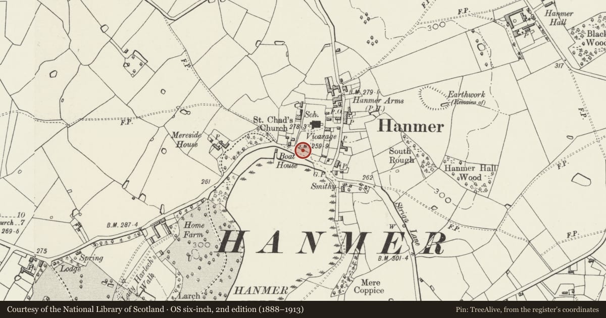
Slide toward Today to fade the historical sheet and see the modern map underneath.
David Rumsey Map Collection, Stanford LibrariesDavid Rumsey Map Collection, Stanford LibrariesDavid Rumsey Map Collection, Stanford LibrariesDavid Rumsey Map Collection, Stanford LibrariesDavid Rumsey Map Collection, Stanford Libraries
5 historical maps cover this location, the earliest the 1637 map "Particular description of Wales. Cambria seu Wallia" (David Rumsey Map Collection, Stanford Libraries).
Historical maps covering this location
- 1637 · Particular description of Wales. Cambria seu Wallia (David Rumsey Map Collection, Stanford Libraries)
- 1861 · 73. Market Drayton. (David Rumsey Map Collection, Stanford Libraries)
- 1883 · Watershed map England, Wales 3. (David Rumsey Map Collection, Stanford Libraries)
- 1897 · 122 Nantwich (Hills) (David Rumsey Map Collection, Stanford Libraries)
- 1901 · Sheet 9 and 10. (David Rumsey Map Collection, Stanford Libraries)
Cadw's description
Location
Set into the S churchyard wall W of the main entrance and opposite Hanmer Mere.
History
Erected in 1919 and designed by Giles Gilbert Scott, architect.
Exterior
A freestone red sandstone war memorial in the style of a medieval churchyard cross, comprising an octagonal shaft with crucifix, on an octagonal base. The base has a commemorative inscription in low relief and roll call in inscribed letters. The tapering shaft has a cornice incorporating a frieze of 4-leaf flowers, and incorporates 2 slender attached shafts that sprout pinnacles flanking the crucifix, and which support the gabled canopy.
To the R and L of the base are added 1939-45 memorial inscriptions on polished granite.
Reason for designation
Listed grade II* for its special interest as an especially fine war memorial by an architect of national reputation, which is in a prominent position that contributes to the overall historical integrity of the parich church.
Nearby in the register
- Gates and gate piers at S entrance to Hanmer churchyardNo class recordedunder 1 mi
- Sundial in Hanmer churchyardNo class recordedunder 1 mi
- Hanmer churchyard crossNo class recordedunder 1 mi
- Hanmer Churchyard CrossCrossunder 1 mi
Other entries of the same register within about three miles of this one, by straight line.