Cof Cymru: National Historic Assets of Wales · Wales
31 North Street
Abergavenny, Monmouthshire, Wales
A Grade II listed building in Abergavenny, Monmouthshire, designated on 10 November 2005.
The record
- Designation
- Listed building, Grade II
- Broad class
- Domestic
- Date of designation
- 10 November 2005
- Locality
- Abergavenny
- Town
- Abergavenny
- Community
- Abergavenny
- Unitary authority
- Monmouthshire
- Country
- Wales
- Coordinates
- 51.82667, -3.02924
- Cadw reference
- 86871
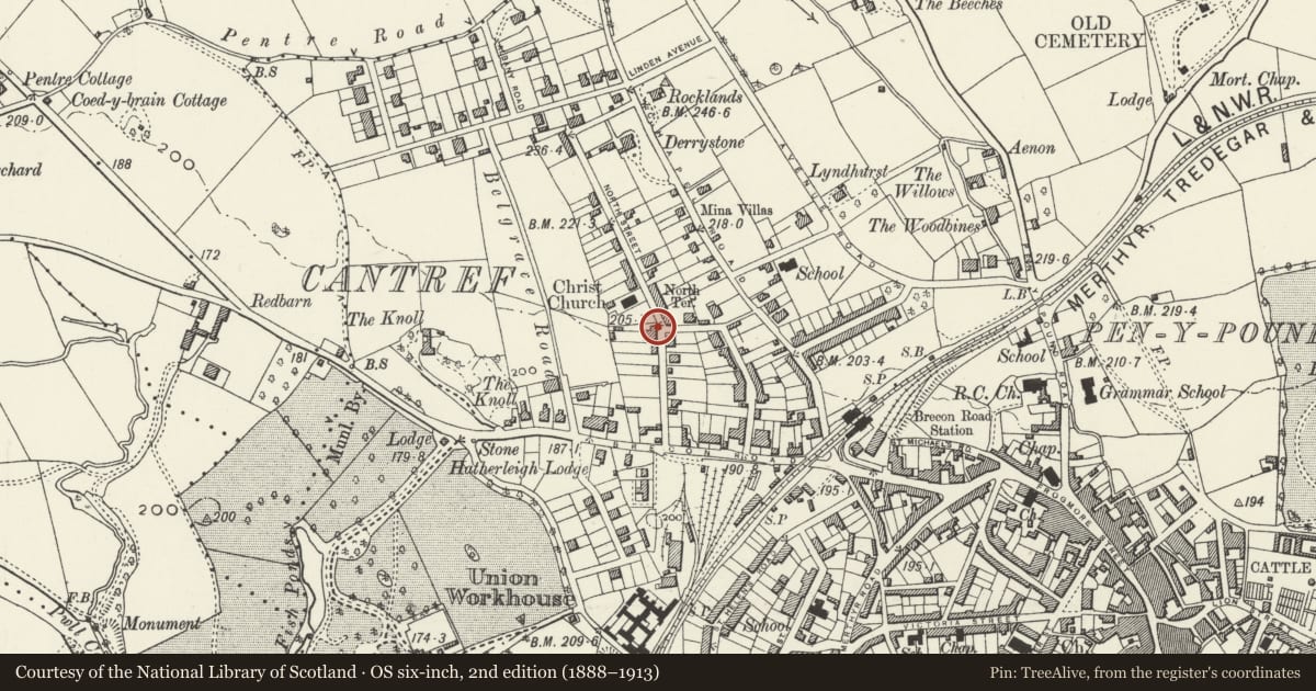
Slide toward Today to fade the historical sheet and see the modern map underneath.
David Rumsey Map Collection, Stanford LibrariesDavid Rumsey Map Collection, Stanford LibrariesDavid Rumsey Map Collection, Stanford LibrariesDavid Rumsey Map Collection, Stanford LibrariesDavid Rumsey Map Collection, Stanford Libraries
5 historical maps cover this location, the earliest the 1636 map "Cornubia : Devonia, Somersetus, Dorcestria, Wiltonia, Glocestria ..." (David Rumsey Map Collection, Stanford Libraries).
Historical maps covering this location
- 1636 · Cornubia : Devonia, Somersetus, Dorcestria, Wiltonia, Glocestria ... (David Rumsey Map Collection, Stanford Libraries)
- 1856 · 42. Brecon. (David Rumsey Map Collection, Stanford Libraries)
- 1898 · 232 Abergavenny (Hills) (David Rumsey Map Collection, Stanford Libraries)
- 1898 · 232 Abergavenny (Outline) (David Rumsey Map Collection, Stanford Libraries)
- 1901 · Sheet 14. (David Rumsey Map Collection, Stanford Libraries)
Cadw's description
Location
On the same side of the road as Christchurch and to the south of it.
History
Early/mid C19 simple classical house, probably c1840, which is very little altered externally since building.
Exterior
Built of coursed squared rock faced stone with a Welsh slate roof and red brick stacks. Double depth central entry plan. Two storeys, three windows. Recessed doorway with late C20 replacement part glazed door. Eight over 8 pane sashes. Low pitch roof with stack at either gable.
Rear elevation not inspected.
Interior
Interior not seen but is said to have a straight flight stair in central hall.
Reason for designation
Included for its special architectural interest as a well preserved early/mid C19 house retaining good character.
Nearby in the register
- Church of ChristchurchReligious, Ritual and Funeraryunder 1 mi
- 65 North StreetNo class recordedunder 1 mi
- Harold Road Junior SchoolEducationunder 1 mi
- Wall, Gates and Railings of Harold Road Junior SchoolNo class recordedunder 1 mi
Other entries of the same register within about three miles of this one, by straight line.