Cof Cymru: National Historic Assets of Wales · Wales
3 Cross Street
Abergavenny, Monmouthshire, Wales
A Grade II listed building in Abergavenny, Monmouthshire, designated on 10 November 2005.
The record
- Designation
- Listed building, Grade II
- Broad class
- No class recorded
- Date of designation
- 10 November 2005
- Locality
- Abergavenny
- Town
- Abergavenny
- Community
- Abergavenny
- Unitary authority
- Monmouthshire
- Country
- Wales
- Coordinates
- 51.82178, -3.01842
- Cadw reference
- 86867
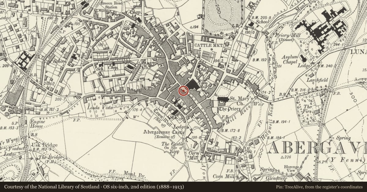
Slide toward Today to fade the historical sheet and see the modern map underneath.
David Rumsey Map Collection, Stanford LibrariesDavid Rumsey Map Collection, Stanford LibrariesDavid Rumsey Map Collection, Stanford LibrariesDavid Rumsey Map Collection, Stanford LibrariesDavid Rumsey Map Collection, Stanford Libraries
5 historical maps cover this location, the earliest the 1636 map "Cornubia : Devonia, Somersetus, Dorcestria, Wiltonia, Glocestria ..." (David Rumsey Map Collection, Stanford Libraries).
Historical maps covering this location
- 1636 · Cornubia : Devonia, Somersetus, Dorcestria, Wiltonia, Glocestria ... (David Rumsey Map Collection, Stanford Libraries)
- 1856 · 42. Brecon. (David Rumsey Map Collection, Stanford Libraries)
- 1898 · 232 Abergavenny (Hills) (David Rumsey Map Collection, Stanford Libraries)
- 1898 · 232 Abergavenny (Outline) (David Rumsey Map Collection, Stanford Libraries)
- 1901 · Sheet 14. (David Rumsey Map Collection, Stanford Libraries)
Cadw's description
Location
Situated opposite the Town Hall on the main commercial street which runs from south-east to north-west across Abergavenny.
History
Early C19, probably 1830s, with a late C20 shopfront and earlier timber-framed origins according to records at RCAHMW.
Exterior
Rendered and painted elevation with a Welsh slate roof and rendered stack. Double depth plan with entry to right. Three storeys, two windows. The ground floor has a late C20 shop front with plate glass display window and continuous fascia. First floor with 6 over 6 pane sashes. Plat band between floors. Six over 6 pane sashes to second floor as before. Deep projecting eaves on paired brackets, plain low pitch roof with stack to right ridge.
Rear elevation not inspected.
Interior
Interior not inspected at resurvey apart from the ground floor which has few historic features.
Reason for designation
Included for its special interest as a well preserved early/mid C19 building retaining its character, which has strong group value with the other historic buildings in the centre of Abergavenny.
Nearby in the register
- 4 Cross StreetDomesticunder 1 mi
- 2 Cross StreetNo class recordedunder 1 mi
- The Abergavenny BookshopCommercialunder 1 mi
- 7 Cross StreetDomesticunder 1 mi
Other entries of the same register within about three miles of this one, by straight line.