Cof Cymru: National Historic Assets of Wales · Wales
65 Frogmore Street
Abergavenny, Monmouthshire, Wales
A Grade II listed building in Abergavenny, Monmouthshire, designated on 10 November 2005.
The record
- Designation
- Listed building, Grade II
- Broad class
- Commercial
- Date of designation
- 10 November 2005
- Locality
- Abergavenny
- Town
- Abergavenny
- Community
- Abergavenny
- Unitary authority
- Monmouthshire
- Country
- Wales
- Coordinates
- 51.82305, -3.01955
- Cadw reference
- 86861
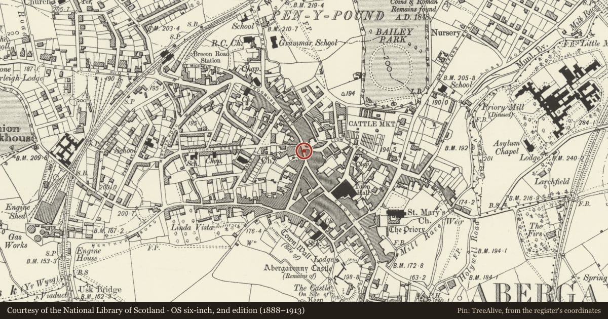
Slide toward Today to fade the historical sheet and see the modern map underneath.
David Rumsey Map Collection, Stanford LibrariesDavid Rumsey Map Collection, Stanford LibrariesDavid Rumsey Map Collection, Stanford LibrariesDavid Rumsey Map Collection, Stanford LibrariesDavid Rumsey Map Collection, Stanford Libraries
5 historical maps cover this location, the earliest the 1636 map "Cornubia : Devonia, Somersetus, Dorcestria, Wiltonia, Glocestria ..." (David Rumsey Map Collection, Stanford Libraries).
Historical maps covering this location
- 1636 · Cornubia : Devonia, Somersetus, Dorcestria, Wiltonia, Glocestria ... (David Rumsey Map Collection, Stanford Libraries)
- 1856 · 42. Brecon. (David Rumsey Map Collection, Stanford Libraries)
- 1898 · 232 Abergavenny (Hills) (David Rumsey Map Collection, Stanford Libraries)
- 1898 · 232 Abergavenny (Outline) (David Rumsey Map Collection, Stanford Libraries)
- 1901 · Sheet 14. (David Rumsey Map Collection, Stanford Libraries)
Cadw's description
Location
Situated on the main commercial street which runs from south-east to north-west across Abergavenny.
History
Built in the early C19, probably together with No. 67 adjoining, and has no visible evidence of earlier origin, C20 shopfront. It is currently undergoing major repairs with possible feature replacement.
Exterior
Plain rendered frontage, probably over brick, Welsh slate roof. Double depth plan. Three storeys, three windows. Altered shopfront with doorway to left. The windows above were hidden at resurvey, but are probably 8 over 8 pane sashes on the first floor and 4 over 8 on the second floor, possibly all with keyed heads as on No. 67. Second floor and eaves bands, plain roof.
Rear elevation both plain and altered.
Interior
Interior not available at resurvey.
Reason for designation
Included for its special interest as an early/mid C19 frontage with definite character that has strong group value with other historic buildings in the centre of Abergavenny.
Nearby in the register
- 67 Frogmore StreetNo class recordedunder 1 mi
- 68 Frogmore StreetCommercialunder 1 mi
- 69 Frogmore StreetNo class recordedunder 1 mi
- 70 Frogmore StreetNo class recordedunder 1 mi
Other entries of the same register within about three miles of this one, by straight line.