Cof Cymru: National Historic Assets of Wales · Wales
Hill Court
Abergavenny, Monmouthshire, Wales
A Grade II listed building in Abergavenny, Monmouthshire, designated on 10 November 2005.
The record
- Designation
- Listed building, Grade II
- Broad class
- Domestic
- Date of designation
- 10 November 2005
- Locality
- Abergavenny
- Town
- Abergavenny
- Community
- Abergavenny
- Unitary authority
- Monmouthshire
- Country
- Wales
- Coordinates
- 51.83251, -3.02672
- Cadw reference
- 86809
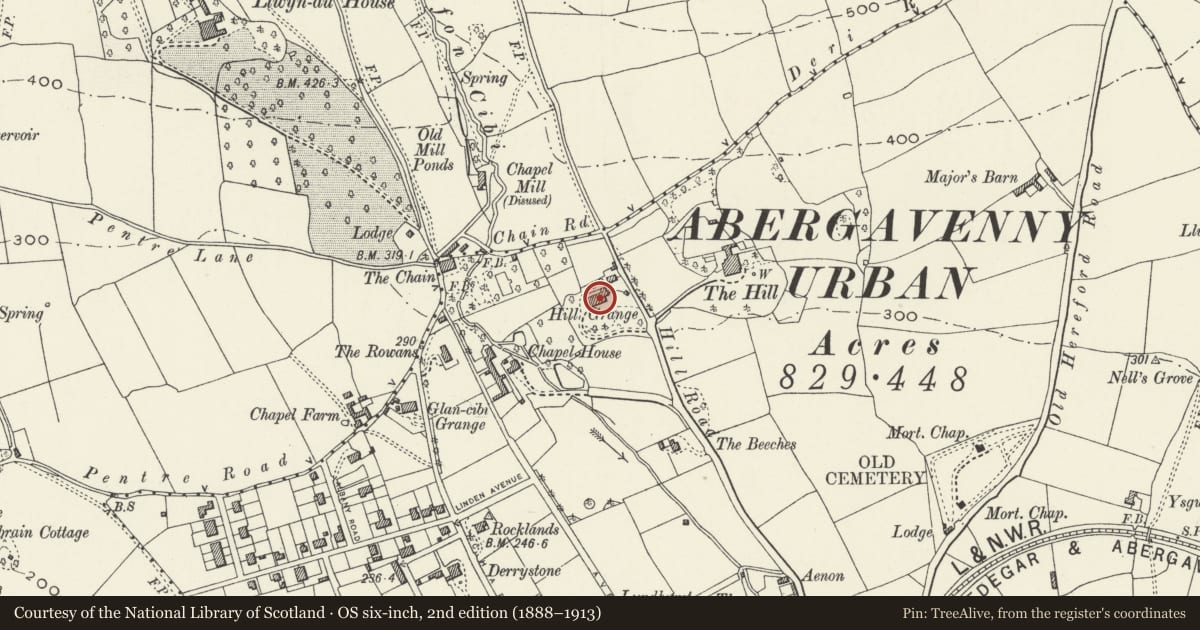
Slide toward Today to fade the historical sheet and see the modern map underneath.
David Rumsey Map Collection, Stanford LibrariesDavid Rumsey Map Collection, Stanford LibrariesDavid Rumsey Map Collection, Stanford LibrariesDavid Rumsey Map Collection, Stanford LibrariesDavid Rumsey Map Collection, Stanford Libraries
5 historical maps cover this location, the earliest the 1636 map "Cornubia : Devonia, Somersetus, Dorcestria, Wiltonia, Glocestria ..." (David Rumsey Map Collection, Stanford Libraries).
Historical maps covering this location
- 1636 · Cornubia : Devonia, Somersetus, Dorcestria, Wiltonia, Glocestria ... (David Rumsey Map Collection, Stanford Libraries)
- 1856 · 42. Brecon. (David Rumsey Map Collection, Stanford Libraries)
- 1898 · 232 Abergavenny (Hills) (David Rumsey Map Collection, Stanford Libraries)
- 1898 · 232 Abergavenny (Outline) (David Rumsey Map Collection, Stanford Libraries)
- 1901 · Sheet 14. (David Rumsey Map Collection, Stanford Libraries)
Cadw's description
Location
Built as a small country house to the north of Abergavenny but now incorporated in the northern built-up area.
History
Mid/late C18 house, said to have been built in 1768 and then altered and extended in 1860. The building appears to have been little altered since then.
Exterior
The main block is faced wholly with cement render, probably over rubblestone, the wings are rendered and painted, Welsh slate roofs and rendered stacks. The original block faces south with C19 additions on the west (entrance) and east. Three storeys with the east wing two storeys and the west wing single storey.
The main south elevation has four windows to the main block with an additional window bay to the left and three more to the right thus 1 + 4 + 3. The ground floor has French casements under an iron tented verandah. The windows above are 6 over 6 pane sashes with 3 over 6 on the top floor. Hipped roof with ridge stacks.
The left return has a Doric porch in antis.
Rear elevation plainer.
Interior
Interior only partly seen at resurvey. The west wing contains the entrance hall and orangery, both are of 1860 and have coved ceilings.
Reason for designation
Included for its special interest a small late C18 country house which was altered and extended in the mid C19 and survives as a handsome ensemble.
Nearby in the register
- The ChapelReligious, Ritual and Funeraryunder 1 mi
- The Tythe BarnNo class recordedunder 1 mi
- The Tythe BarnNo class recordedunder 1 mi
- The Tythe BarnNo class recordedunder 1 mi
Other entries of the same register within about three miles of this one, by straight line.