Cof Cymru: National Historic Assets of Wales · Wales
Waterloo House
Llanfyllin, Powys, Wales
A Grade II listed building in Llanfyllin, Powys, designated on 22 March 1993.
The record
- Designation
- Listed building, Grade II
- Broad class
- Domestic
- Date of designation
- 22 March 1993
- Community
- Llanfyllin
- Unitary authority
- Powys
- Country
- Wales
- Coordinates
- 52.76635, -3.27320
- Cadw reference
- 8593
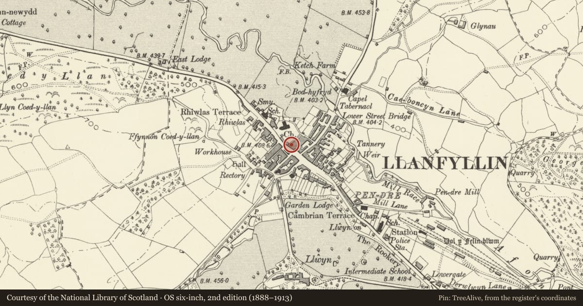
Slide toward Today to fade the historical sheet and see the modern map underneath.
David Rumsey Map Collection, Stanford LibrariesDavid Rumsey Map Collection, Stanford LibrariesDavid Rumsey Map Collection, Stanford LibrariesLlyfrgell Genedlaethol Cymru – The National Library of WalesDavid Rumsey Map Collection, Stanford Libraries
5 historical maps cover this location, the earliest the 1795 map "To Sir Watkin Williams-Wynn Bart ... the map of the six counties of North Wales is most humbly inscribed by his obedient humble servant" (Llyfrgell Genedlaethol Cymru – The National Library of Wales).
Historical maps covering this location
- 1795 · To Sir Watkin Williams-Wynn Bart ... the map of the six counties of North Wales is most… (Llyfrgell Genedlaethol Cymru – The National Library of Wales)
- 1883 · Watershed map England, Wales 3. (David Rumsey Map Collection, Stanford Libraries)
- 1897 · 137 Oswestry (Hills) (David Rumsey Map Collection, Stanford Libraries)
- 1901 · Sheet 9 and 10. (David Rumsey Map Collection, Stanford Libraries)
- 1916 · Sheet 60. Shrewsbury. (David Rumsey Map Collection, Stanford Libraries)
Cadw's description
Location
To L of National Westminster Bank.
History
Probably early C19 rebuilding and refronting of C16/C17 house parts of which are visible to rear. Formerly known as Waterloo House. General store in later C19, becoming branch of National Provincial Bank circa 1905 before new building next door opened circa 1915.
Exterior
Three storey, three window shop; local brick front (rendered), slate roof, square brick chimney to front of ridge. Second floor has three almost square windows, modern glazing replacing eight-pane hornless sashes but respecting original openings, stone sills. On first floor, three windows (modern glazing) replacing sixteen-pane sash windows, stone sills. On ground floor, to R, sixteen-pane window; to L, later C19 shopfront with central door (part glazed, with overlight) with shop window to each side; windows flanked by classically derived pilasters supporting volutes, and fascia with cornice.
R gable facing bank is small-scantling timber-framing.
To rear, facing churchyard, top storey has had eaves raised in small-scantling timber-framing; brick chimney stack to L. On ground floor, crosswing of C16/C17. Gable has heavy collar and tiebeam truss with raking struts above collar; small-pane casement window. On ground floor, broad window with iron grille.
Reason for designation
Group value.
Nearby in the register
- National Westminster BankCommercialunder 1 mi
- 38 High StreetCommercialunder 1 mi
- 40 High StreetCommercialunder 1 mi
- Cain Valley HotelCommercialunder 1 mi
Other entries of the same register within about three miles of this one, by straight line.