Cof Cymru: National Historic Assets of Wales · Wales
8 Penybryn
Llanfyllin, Powys, Wales
A Grade II listed building in Llanfyllin, Powys, designated on 22 March 1993.
The record
- Designation
- Listed building, Grade II
- Broad class
- Domestic
- Date of designation
- 22 March 1993
- Town
- Llanfyllin
- Community
- Llanfyllin
- Unitary authority
- Powys
- Country
- Wales
- Coordinates
- 52.76550, -3.27232
- Cadw reference
- 8586
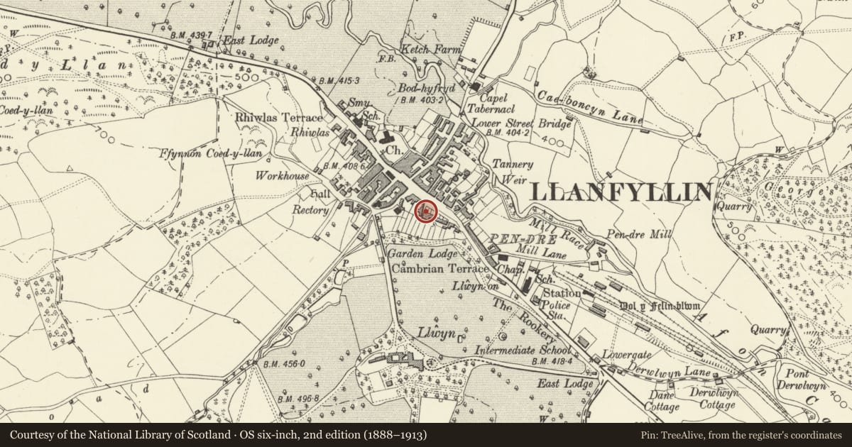
Slide toward Today to fade the historical sheet and see the modern map underneath.
David Rumsey Map Collection, Stanford LibrariesDavid Rumsey Map Collection, Stanford LibrariesDavid Rumsey Map Collection, Stanford LibrariesLlyfrgell Genedlaethol Cymru – The National Library of WalesDavid Rumsey Map Collection, Stanford Libraries
5 historical maps cover this location, the earliest the 1795 map "To Sir Watkin Williams-Wynn Bart ... the map of the six counties of North Wales is most humbly inscribed by his obedient humble servant" (Llyfrgell Genedlaethol Cymru – The National Library of Wales).
Historical maps covering this location
- 1795 · To Sir Watkin Williams-Wynn Bart ... the map of the six counties of North Wales is most… (Llyfrgell Genedlaethol Cymru – The National Library of Wales)
- 1883 · Watershed map England, Wales 3. (David Rumsey Map Collection, Stanford Libraries)
- 1897 · 137 Oswestry (Hills) (David Rumsey Map Collection, Stanford Libraries)
- 1901 · Sheet 9 and 10. (David Rumsey Map Collection, Stanford Libraries)
- 1916 · Sheet 60. Shrewsbury. (David Rumsey Map Collection, Stanford Libraries)
Cadw's description
Location
Above level of main road, behind small foregardens.
History
Earlier C19 pair of houses.
Exterior
Rubble with painted quoins, slate roof, rectangular yellow brick end chimneys. Two-and-a-half storey, asymmetrical front. Central gable, pinnacled, has narrow camber-headed casement window. First floor has three square-headed windows with painted quoins and lintels, sixteen-pane hornless sash glazing, R window offset slightly to R. On ground floor, pair of doorways, L doorway aligned below central first floor window, R doorway offset. Doorways have painted lintels and quoins, rectangular overlights; six-panelled doors of slightly different design.
Reason for designation
Group value.
Nearby in the register
- 9 PenybrynDomesticunder 1 mi
- 5 PenybrynDomesticunder 1 mi
- 4 PenybrynDomesticunder 1 mi
- 2 PenybrynCommercialunder 1 mi
Other entries of the same register within about three miles of this one, by straight line.