Cof Cymru: National Historic Assets of Wales · Wales
Rhiwlas Terrace
Llanfyllin, Powys, Wales
A Grade II listed building in Llanfyllin, Powys, designated on 22 March 1993.
The record
- Designation
- Listed building, Grade II
- Broad class
- Domestic
- Date of designation
- 22 March 1993
- Community
- Llanfyllin
- Unitary authority
- Powys
- Country
- Wales
- Coordinates
- 52.76738, -3.27525
- Cadw reference
- 8563
Slide toward Today to fade the historical sheet and see the modern map underneath.
David Rumsey Map Collection, Stanford LibrariesDavid Rumsey Map Collection, Stanford LibrariesDavid Rumsey Map Collection, Stanford LibrariesLlyfrgell Genedlaethol Cymru – The National Library of WalesDavid Rumsey Map Collection, Stanford Libraries
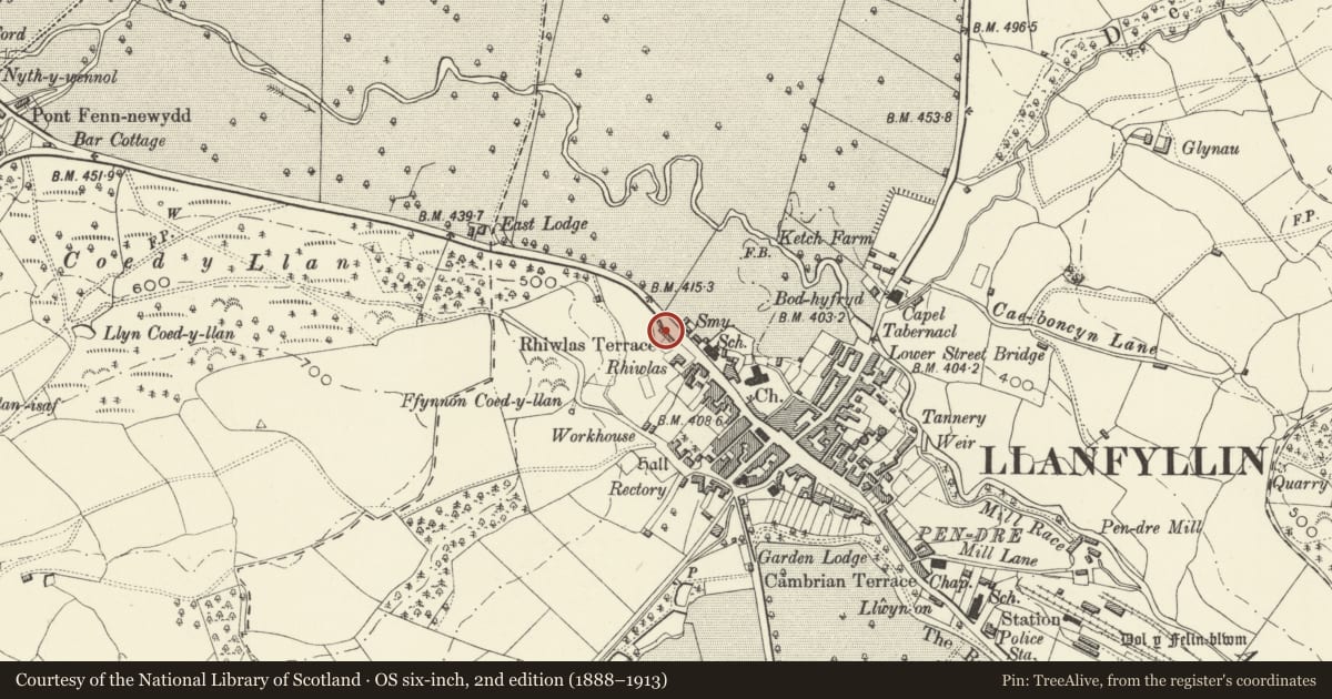
5 historical maps cover this location, the earliest the 1795 map "To Sir Watkin Williams-Wynn Bart ... the map of the six counties of North Wales is most humbly inscribed by his obedient humble servant" (Llyfrgell Genedlaethol Cymru – The National Library of Wales).
Historical maps covering this location
- 1795 · To Sir Watkin Williams-Wynn Bart ... the map of the six counties of North Wales is most… (Llyfrgell Genedlaethol Cymru – The National Library of Wales)
- 1883 · Watershed map England, Wales 3. (David Rumsey Map Collection, Stanford Libraries)
- 1897 · 137 Oswestry (Hills) (David Rumsey Map Collection, Stanford Libraries)
- 1901 · Sheet 9 and 10. (David Rumsey Map Collection, Stanford Libraries)
- 1916 · Sheet 60. Shrewsbury. (David Rumsey Map Collection, Stanford Libraries)
Cadw's description
Location
Parallel to road at slightly lower level.
History
Took present form circa 1800 but central heavier-built section probably has earlier (C17) origins.
Exterior
Timber-framed terrace of seven workers cottages; four pressed brick chimneys (early C20), R chimney taller to rise above adjacent house; slate roof. Three mirrored pairs with extra later house to R; houses have single window to each floor. Large square-framed panels with one straight angle-brace visible (others apparent in old photos); heavy timbers to central section; end houses to L have timbers of lighter build, but same design; end house to R has timbers of lighter build again, and different frame pattern. Most of houses retain twelve-pane Yorkshire (horizontal) sash window to each floor and Nos 4 and 6 retain simple boarded doors.
Reason for designation
Group value.
Nearby in the register
- Rhiwlas TerraceDomesticunder 1 mi
- Rhiwlas TerraceDomesticunder 1 mi
- Rhiwlas TerraceDomesticunder 1 mi
- Rhiwlas TerraceDomesticunder 1 mi
Other entries of the same register within about three miles of this one, by straight line.