Cof Cymru: National Historic Assets of Wales · Wales
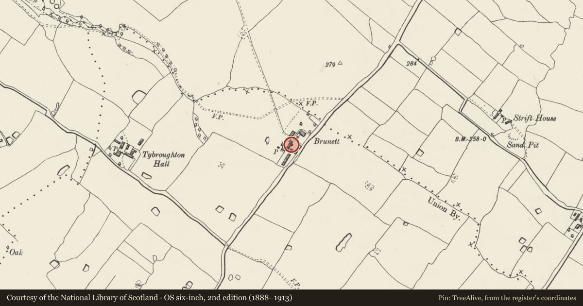
Shippon at Brunett Farm
Bronington, Wrexham, Wales
A Grade II listed building in Tybroughton, Bronington, Wrexham, designated on 20 October 2005.
The record
- Designation
- Listed building, Grade II
- Broad class
- No class recorded
- Date of designation
- 20 October 2005
- Locality
- Tybroughton
- Community
- Bronington
- Unitary authority
- Wrexham
- Country
- Wales
- Coordinates
- 52.98140, -2.78777
- Cadw reference
- 85483
Slide toward Today to fade the historical sheet and see the modern map underneath.
David Rumsey Map Collection, Stanford LibrariesDavid Rumsey Map Collection, Stanford LibrariesDavid Rumsey Map Collection, Stanford LibrariesDavid Rumsey Map Collection, Stanford LibrariesDavid Rumsey Map Collection, Stanford Libraries
5 historical maps cover this location, the earliest the 1637 map "Particular description of Wales. Cambria seu Wallia" (David Rumsey Map Collection, Stanford Libraries).
Historical maps covering this location
- 1637 · Particular description of Wales. Cambria seu Wallia (David Rumsey Map Collection, Stanford Libraries)
- 1861 · 73. Market Drayton. (David Rumsey Map Collection, Stanford Libraries)
- 1883 · Watershed map England, Wales 3. (David Rumsey Map Collection, Stanford Libraries)
- 1897 · 122 Nantwich (Hills) (David Rumsey Map Collection, Stanford Libraries)
- 1901 · Sheet 9 and 10. (David Rumsey Map Collection, Stanford Libraries)
Cadw's description
Location
On the SW side of the farmhouse.
History
An C18 farm building shown on the 1839 Tithe map.
Exterior
A lofted farm building, timber-framed and incorporating full-height diagonal tension braces, with partly replaced brick nogging, and corrugated-iron roof. Facing the yard are 8 original doorways, 2 of which are blocked, 2 have replacement doors, and 4 have been converted to windows. In the loft are 3 inserted windows and 2 loading doors to the L. The R gable end has an inserted door to the R, 4 large diamond pattern ventilators forming a diamond pattern around a loft opening now glazed. The L gable end has diamond-pattern breathers and loft opening.
In the rear, where part of the framing has been replaced in brick, are 5 inserted doorways and 2 small inserted windows.
Reason for designation
Listed as a large farm building retaining definite C19 character, and for group value with the house.
Nearby in the register
- Brunett Farmhouse and Brunett AnnexeDomesticunder 1 mi
- Stable and cart house at Tybroughton HallNo class recordedunder 1 mi
- Tybroughton HallNo class recordedunder 1 mi
- Farm buildings at Higher Lanes FarmNo class recordedunder 1 mi
Other entries of the same register within about three miles of this one, by straight line.