Cof Cymru: National Historic Assets of Wales · Wales
Kitchen garden walls at Iscoyd Park
Bronington, Wrexham, Wales
A Grade II listed building in Iscoyd, Bronington, Wrexham, designated on 20 October 2005.
The record
- Designation
- Listed building, Grade II
- Broad class
- No class recorded
- Date of designation
- 20 October 2005
- Locality
- Iscoyd
- Community
- Bronington
- Unitary authority
- Wrexham
- Country
- Wales
- Coordinates
- 52.97413, -2.73989
- Cadw reference
- 85471
Slide toward Today to fade the historical sheet and see the modern map underneath.
David Rumsey Map Collection, Stanford LibrariesDavid Rumsey Map Collection, Stanford LibrariesDavid Rumsey Map Collection, Stanford LibrariesDavid Rumsey Map Collection, Stanford LibrariesDavid Rumsey Map Collection, Stanford Libraries
5 historical maps cover this location, the earliest the 1637 map "Particular description of Wales. Cambria seu Wallia" (David Rumsey Map Collection, Stanford Libraries).
Historical maps covering this location
- 1637 · Particular description of Wales. Cambria seu Wallia (David Rumsey Map Collection, Stanford Libraries)
- 1861 · 73. Market Drayton. (David Rumsey Map Collection, Stanford Libraries)
- 1883 · Watershed map England, Wales 3. (David Rumsey Map Collection, Stanford Libraries)
- 1897 · 122 Nantwich (Hills) (David Rumsey Map Collection, Stanford Libraries)
- 1901 · Sheet 9 and 10. (David Rumsey Map Collection, Stanford Libraries)
Cadw's description
Location
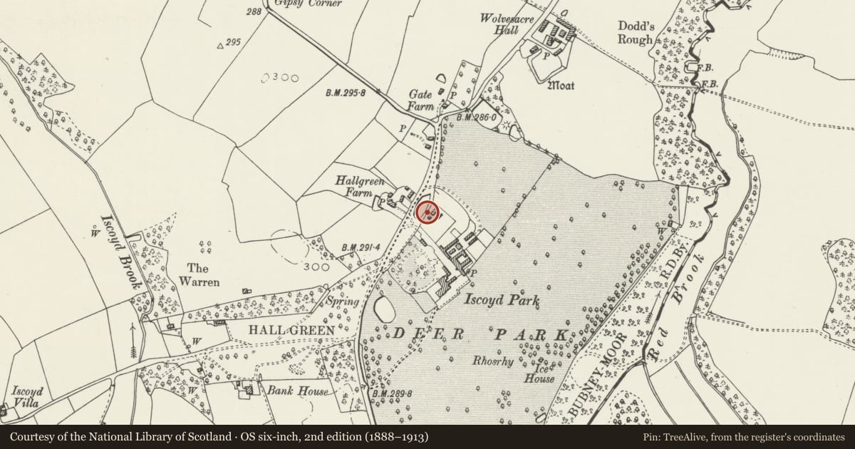
To the N of the house and service buildings and set back from the minor road to Higher Wych.
History
Iscoyd Park was built in the early C18 and was extended by William Hanmer in 1747. From 1780 it was owned by Rev Richard Congreve (d 1782) and his descendants, who sold it to Philip Lake Godsal in 1843. The walled garden is shown on an estate plan of 1780, and 2 other near-contemporary plans. Its S side, attached to a contemporary laundry, was probable never walled.
Exterior
Garden walls on 3 sides covering an area approximately 80x60m, of brick with freestone coping. The W side fronts the back drive to the house. The S side is occupied by shippons and iron railings. The E wall has 3 segmental-headed boarded doors. The W side has 2 similar doors, abuts the laundry at the SW end, and abuts a gate pier at the NW end at the back entrance to the house.
Reason for designation
Listed for its special interest as walls to a well-preserved kitchen garden, part of a remarkably intact ensemble of C18 outbuildings and structures, and for its contribution to the historical integrity of the house and its outbuildings.
Nearby in the register
- Gate piers and attached walls to back drive to Iscoyd ParkNo class recordedunder 1 mi
- Coach house and granary on back drive to Iscoyd ParkNo class recordedunder 1 mi
- 1 Hall Green CottagesNo class recordedunder 1 mi
- 2 Hall Green CottagesNo class recordedunder 1 mi
Other entries of the same register within about three miles of this one, by straight line.