Cof Cymru: National Historic Assets of Wales · Wales
Higher Barns Lodge
Bronington, Wrexham, Wales
A Grade II listed building in Lower Wych, Bronington, Wrexham, designated on 20 October 2005.
The record
- Designation
- Listed building, Grade II
- Broad class
- No class recorded
- Date of designation
- 20 October 2005
- Locality
- Lower Wych
- Community
- Bronington
- Unitary authority
- Wrexham
- Country
- Wales
- Coordinates
- 52.98787, -2.77934
- Cadw reference
- 85465
Slide toward Today to fade the historical sheet and see the modern map underneath.
David Rumsey Map Collection, Stanford LibrariesDavid Rumsey Map Collection, Stanford LibrariesDavid Rumsey Map Collection, Stanford LibrariesDavid Rumsey Map Collection, Stanford LibrariesDavid Rumsey Map Collection, Stanford Libraries
5 historical maps cover this location, the earliest the 1637 map "Particular description of Wales. Cambria seu Wallia" (David Rumsey Map Collection, Stanford Libraries).
Historical maps covering this location
- 1637 · Particular description of Wales. Cambria seu Wallia (David Rumsey Map Collection, Stanford Libraries)
- 1861 · 73. Market Drayton. (David Rumsey Map Collection, Stanford Libraries)
- 1883 · Watershed map England, Wales 3. (David Rumsey Map Collection, Stanford Libraries)
- 1897 · 122 Nantwich (Hills) (David Rumsey Map Collection, Stanford Libraries)
- 1901 · Sheet 9 and 10. (David Rumsey Map Collection, Stanford Libraries)
Cadw's description
Location
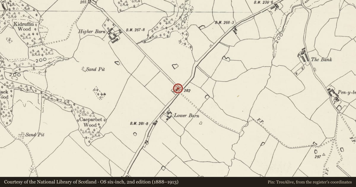
On the NW side of a minor road between Lower Wych and Tybroughton.
History
A cottage dated 1875, part of a smallholding very similar to those built for the Iscoyd Park estate in the latter half of the nineteenth century. It is shown on the 1911 Ordnance Survey.
Exterior
A 1½-storey cottage of brick with slate roof on overhanging eaves with dentil verge. Openings have mostly stone lintels and windows are small-pane wood-framed casements. The original entrance is in the NE gable end. It has a faceted boarded door to the L, the lintel of which is inscribed 'JBC 1875', a 2-light casement to its R and to the attic. The 2-window L side wall facing the road has 3-light casements. The R side wall has 2 small segmental-headed windows. The rear has a boarded door and 2-light casement window to its L, below a 2-light attic window.
Interior
Not inspected.
Reason for designation
Listed for its special historic interest as part of a well-preserved C19 smallholding, a type characteristic of the district.
Nearby in the register
- Shippon and piggery at Higher Barns LodgeNo class recordedunder 1 mi
- Pen-y-brynDomesticunder 1 mi
- Brunett Farmhouse and Brunett AnnexeDomesticunder 1 mi
- Ty bach at Higher Lanes Bank FarmNo class recordedunder 1 mi
Other entries of the same register within about three miles of this one, by straight line.