Cof Cymru: National Historic Assets of Wales · Wales
Browsers Bookshop and house
Porthmadog, Gwynedd, Wales
A Grade II listed building in Porthmadog, Gwynedd, designated on 26 September 2005.
The record
- Designation
- Listed building, Grade II
- Broad class
- No class recorded
- Date of designation
- 26 September 2005
- Locality
- Porthmadog
- Town
- Porthmadog
- Community
- Porthmadog
- Unitary authority
- Gwynedd
- Country
- Wales
- Coordinates
- 52.92680, -4.13110
- Cadw reference
- 85369
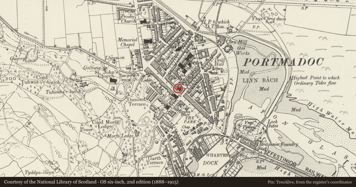
Slide toward Today to fade the historical sheet and see the modern map underneath.
David Rumsey Map Collection, Stanford LibrariesDavid Rumsey Map Collection, Stanford LibrariesDavid Rumsey Map Collection, Stanford LibrariesLlyfrgell Genedlaethol Cymru – The National Library of WalesDavid Rumsey Map Collection, Stanford Libraries
5 historical maps cover this location, the earliest the 1795 map "To Sir Watkin Williams-Wynn Bart ... the map of the six counties of North Wales is most humbly inscribed by his obedient humble servant" (Llyfrgell Genedlaethol Cymru – The National Library of Wales).
Historical maps covering this location
- 1795 · To Sir Watkin Williams-Wynn Bart ... the map of the six counties of North Wales is most… (Llyfrgell Genedlaethol Cymru – The National Library of Wales)
- 1883 · Watershed map England, Wales 3. (David Rumsey Map Collection, Stanford Libraries)
- 1896 · Sheet 7. Ordnance Survey of England and Wales. (David Rumsey Map Collection, Stanford Libraries)
- 1899 · 119 Snowdon (Hills) (David Rumsey Map Collection, Stanford Libraries)
- 1901 · Sheet 9 and 10. (David Rumsey Map Collection, Stanford Libraries)
Cadw's description
Location
In a terrace of shops immediately NW of Capel Salem.
History
Built in the mid C19 as a shop and house and shown on the 1871 Tremadog estate plan and 1888 Ordnance Survey.
Exterior
A 3-storey 2-window shop and house of squared stone blocks laid in regular courses and painted white, slate roof, pebble-dashed stack to the R and original shared stone stack to the L. In the lower storey the house entrance is on the R side, raised above street level and reached up stone steps. It has a fielded-panel door and overlight. The shop has shallow bay windows of 2 panes each flanking a central recessed half-lit fielded-panel door incorporating similar panels to its L and an overlight. Over the shop front is a cornice with moulded billet frieze, above which is an awning. In the middle and upper storeys the windows are offset to the R and are 12-pane horned sashes in the middle storey, shorter 9-pane sashes in the upper storey.
The R gable end, facing Capel Salem, is slate-hung above a cement-rendered lower storey. The rear has a 1-storey flat-roof projection, above which are small-pane sash windows, including a stair window to the L.
Interior
Not inspected.
Reason for designation
Listed for its special architectural interest as a well-preserved town house and shop of definite C19 character, notable for its distinctive use of local materials and retentiion of an early shop front. Forms a strong visual group with the adjacent Capel Salem.
Nearby in the register
- Capel Salem, including attached Sunday School, forecourt gates and railings and hall to rearReligious, Ritual and Funeraryunder 1 mi
- Y Pisgotwr (The Fisherman)No class recordedunder 1 mi
- Jessie's Deli and houseNo class recordedunder 1 mi
- HSBC BankNo class recordedunder 1 mi
Other entries of the same register within about three miles of this one, by straight line.