Cof Cymru: National Historic Assets of Wales · Wales
Garthowen, Marine Terrace
Porthmadog, Gwynedd, Wales
A Grade II listed building in Porthmadog, Gwynedd, designated on 26 September 2005.
The record
- Designation
- Listed building, Grade II
- Broad class
- No class recorded
- Date of designation
- 26 September 2005
- Locality
- Porthmadog
- Town
- Porthmadog
- Community
- Porthmadog
- Unitary authority
- Gwynedd
- Country
- Wales
- Coordinates
- 52.92233, -4.13097
- Cadw reference
- 85364
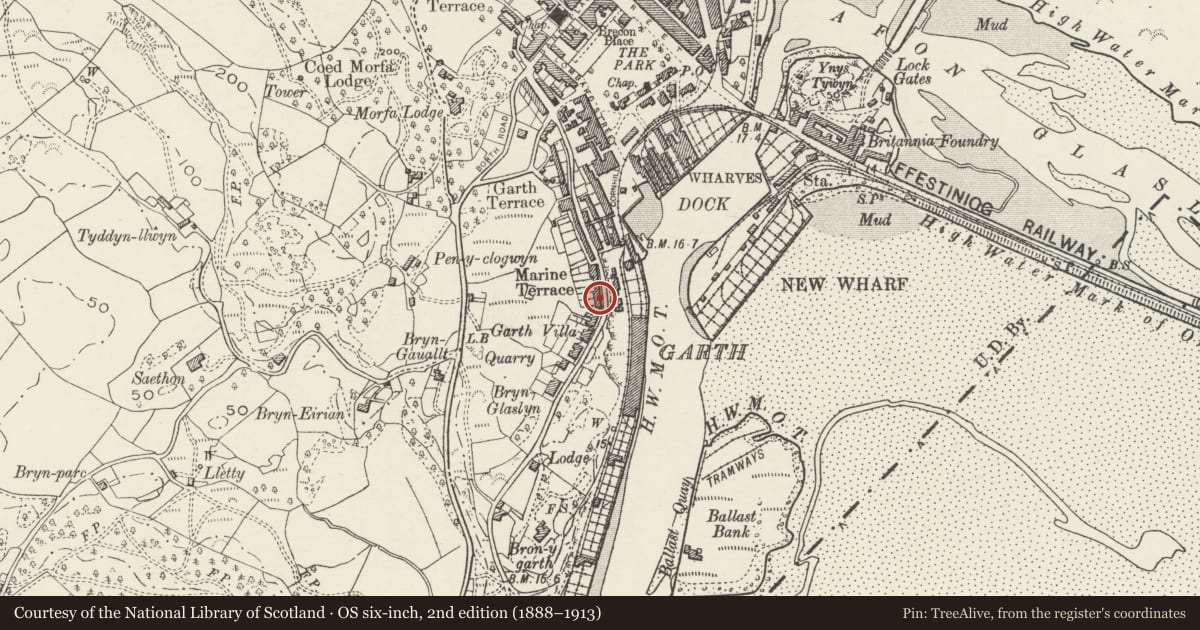
Slide toward Today to fade the historical sheet and see the modern map underneath.
David Rumsey Map Collection, Stanford LibrariesDavid Rumsey Map Collection, Stanford LibrariesDavid Rumsey Map Collection, Stanford LibrariesLlyfrgell Genedlaethol Cymru – The National Library of WalesDavid Rumsey Map Collection, Stanford Libraries
5 historical maps cover this location, the earliest the 1795 map "To Sir Watkin Williams-Wynn Bart ... the map of the six counties of North Wales is most humbly inscribed by his obedient humble servant" (Llyfrgell Genedlaethol Cymru – The National Library of Wales).
Historical maps covering this location
- 1795 · To Sir Watkin Williams-Wynn Bart ... the map of the six counties of North Wales is most… (Llyfrgell Genedlaethol Cymru – The National Library of Wales)
- 1883 · Watershed map England, Wales 3. (David Rumsey Map Collection, Stanford Libraries)
- 1896 · Sheet 7. Ordnance Survey of England and Wales. (David Rumsey Map Collection, Stanford Libraries)
- 1899 · 119 Snowdon (Hills) (David Rumsey Map Collection, Stanford Libraries)
- 1901 · Sheet 9 and 10. (David Rumsey Map Collection, Stanford Libraries)
Cadw's description
Location
A terraced house on the hillside to the W of and overlooking the harbour.
History
Marine Terrace is first shown in a view of Porthmadog by C.F. Williams, dated 1849, and is mentioned by Owen Morris in 1856. The terrace is shown on the 1871 Tremadog estate plan and 1888 Ordnance Survey. No 6 is a mid C19 house but was later remodelled, together with No 7, to create the present roughcast front, to which the porch was added later still.
Exterior
A 3-storey 3-bay late-Georgian style house of roughcast front with rusticated quoin strips, over slate-stone, slate roof on projecting eaves in a range with No 7, and roughcast stack to the L and stone stack to the R. A central added porch has a flat roof concealed behind a moulded cornice. It has a half-glazed fielded-panel door with small-pane glazing incorporating a small diamond light and beneath an Art Nouveau coloured-glass overlight. On its L side is a small-pane window incorporating a circular light, and small lights are in the side walls. Windows to the main house are under hood moulds in the lower 2 storeys, are 12-pane hornless sashes in the lower storey, 16-pane hornless sashes in the middle and upper storeys.
Interior
Not inspected.
Reason for designation
Listed for its special architectural interest as a well-preserved substantial town house retaining good detail and definite Georgian character; with No 7, part of a well-preserved C19 terrace overlooking the harbour and the Cob.
Nearby in the register
- Afallon, Marine TerraceNo class recordedunder 1 mi
- Aberteg, Marine TerraceNo class recordedunder 1 mi
- Wenallt, Marine TerraceNo class recordedunder 1 mi
- Belle Vue, including forecourt wall and railingsNo class recordedunder 1 mi
Other entries of the same register within about three miles of this one, by straight line.