Cof Cymru: National Historic Assets of Wales · Wales
Street House
Llandysilio, Powys, Wales
A Grade II listed building in Four Crosses, Llandysilio, Powys, designated on 5 April 1993.
The record
- Designation
- Listed building, Grade II
- Broad class
- Domestic
- Date of designation
- 5 April 1993
- Locality
- Four Crosses
- Community
- Llandysilio
- Unitary authority
- Powys
- Country
- Wales
- Coordinates
- 52.76066, -3.08370
- Cadw reference
- 8530
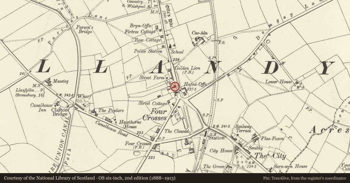
Slide toward Today to fade the historical sheet and see the modern map underneath.
David Rumsey Map Collection, Stanford LibrariesDavid Rumsey Map Collection, Stanford LibrariesDavid Rumsey Map Collection, Stanford LibrariesDavid Rumsey Map Collection, Stanford LibrariesLlyfrgell Genedlaethol Cymru – The National Library of Wales
5 historical maps cover this location, the earliest the 1795 map "To Sir Watkin Williams-Wynn Bart ... the map of the six counties of North Wales is most humbly inscribed by his obedient humble servant" (Llyfrgell Genedlaethol Cymru – The National Library of Wales).
Historical maps covering this location
- 1795 · To Sir Watkin Williams-Wynn Bart ... the map of the six counties of North Wales is most… (Llyfrgell Genedlaethol Cymru – The National Library of Wales)
- 1883 · Watershed map England, Wales 3. (David Rumsey Map Collection, Stanford Libraries)
- 1897 · 137 Oswestry (Hills) (David Rumsey Map Collection, Stanford Libraries)
- 1901 · Sheet 9 and 10. (David Rumsey Map Collection, Stanford Libraries)
- 1916 · Sheet 60. Shrewsbury. (David Rumsey Map Collection, Stanford Libraries)
Cadw's description
Location
Prominent position behind roadside wall, on A483 in Four Crosses.
History
First half of C19.
Exterior
Three storeys, double pile, brick with dentil eaves,slate roof, two brick ridge stacks. Symmetrical front with windows set towards the corners. Ground and first floor windows, tall double hung sashes, attic windows one-and-a-half sashes all with glazing bars and under painted flat arches. Similar window arrangement on south gable except for modern bay replacing ground floor rear sash. North gable blind. Central panelled front door (now blocked) with flat moulded canopy on carved brackets carried over double width pilaster surround. Rear elevation has tall, thin three-storey high stair light with horizontal glazing bars.
Reason for designation
Group value with the listed buildings running N from Domgay House.
Nearby in the register
- Former Domgay ChapelReligious, Ritual and Funeraryunder 1 mi
- Domgay HouseDomesticunder 1 mi
- The Golden LionCommercialunder 1 mi
- Old Milk Factory (Ice Cremery) adjacent to Greenfield HouseCommercialunder 1 mi
Other entries of the same register within about three miles of this one, by straight line.