Cof Cymru: National Historic Assets of Wales · Wales
Former Barn, Old Quay House Inn
Connah's Quay, Flintshire, Wales
A Grade II listed building in Connah's Quay, Deeside, Flintshire, designated on 26 August 2005.
The record
- Designation
- Listed building, Grade II
- Broad class
- No class recorded
- Date of designation
- 26 August 2005
- Locality
- Connah's Quay
- Town
- Deeside
- Community
- Connah's Quay
- Unitary authority
- Flintshire
- Country
- Wales
- Coordinates
- 53.22124, -3.05980
- Cadw reference
- 85257
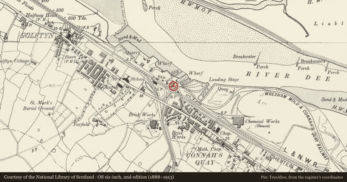
Slide toward Today to fade the historical sheet and see the modern map underneath.
David Rumsey Map Collection, Stanford LibrariesDavid Rumsey Map Collection, Stanford LibrariesDavid Rumsey Map Collection, Stanford LibrariesDavid Rumsey Map Collection, Stanford LibrariesLlyfrgell Genedlaethol Cymru – The National Library of Wales
5 historical maps cover this location, the earliest the 1795 map "To Sir Watkin Williams-Wynn Bart ... the map of the six counties of North Wales is most humbly inscribed by his obedient humble servant" (Llyfrgell Genedlaethol Cymru – The National Library of Wales).
Historical maps covering this location
- 1795 · To Sir Watkin Williams-Wynn Bart ... the map of the six counties of North Wales is most… (Llyfrgell Genedlaethol Cymru – The National Library of Wales)
- 1883 · Watershed map England, Wales 3. (David Rumsey Map Collection, Stanford Libraries)
- 1898 · 108 Flint (Hills) (David Rumsey Map Collection, Stanford Libraries)
- 1898 · 108 Flint (Outline) (David Rumsey Map Collection, Stanford Libraries)
- 1901 · Sheet 9 and 10. (David Rumsey Map Collection, Stanford Libraries)
Cadw's description
Location
Located to the rear of and at right angles to the Old Quay House Inn. A 2nd parallel outbuilding to the W, now converted to accommodation, formed the 3rd side to a small yard.
History
Old Quay House, dated 1777, was originally a farm. It had been converted to an Inn by the late C19 and was closely associated with the docks. The Inn was rebuilt in the early C20, the old datestone reset into the front wall. This barn is probably contemporary with the original farmhouse (1777) and is shown on the Tithe map of 1839. It is now partly converted to accommodation.
Exterior
Symmetrical 3-bay lofted range constructed of coursed blocks of yellow sandstone under an old slate roof. Dressed sandstone quoins with moulded kneelers and raised stone copings. Wide central entrance with elliptical-arched head, of dressed sandstone. This is flanked by circular pitching eyes to loft, each set within a square ashlar panel. Ventilation slits above entrance and to each side. N gable end has boarded door to L under a wedge lintel; no openings to S gable end. Rear has opposing elliptical-arched opening to through-passage, 2 openings to R with wedge lintels, detail not seen. Two added timber dormers to loft, probably late C20; skylight.
Interior
Interior not seen at time of survey.
Reason for designation
Listed as a good Georgian farm building retaining much of its architectural character and detail, and for group value with Old Quay House Inn and the dock basin which it overlooks.
Nearby in the register
- Old Quay House InnNo class recordedunder 1 mi
- Dock BasinNo class recordedunder 1 mi
- Church of St MarkNo class recordedunder 1 mi
- Lychgate at Church of St MarkNo class recordedunder 1 mi
Other entries of the same register within about three miles of this one, by straight line.