Cof Cymru: National Historic Assets of Wales · Wales
Princes Pier Wharf
Menai Bridge, Isle of Anglesey, Wales
A Grade II listed building in Menai Bridge, Isle of Anglesey, designated on 14 September 2005.
The record
- Designation
- Listed building, Grade II
- Broad class
- Transport
- Date of designation
- 14 September 2005
- Locality
- Menai Bridge
- Community
- Menai Bridge
- Unitary authority
- Isle of Anglesey
- Country
- Wales
- Coordinates
- 53.22412, -4.16073
- Cadw reference
- 85243
Slide toward Today to fade the historical sheet and see the modern map underneath.
David Rumsey Map Collection, Stanford LibrariesDavid Rumsey Map Collection, Stanford LibrariesDavid Rumsey Map Collection, Stanford LibrariesDavid Rumsey Map Collection, Stanford LibrariesDavid Rumsey Map Collection, Stanford Libraries
5 historical maps cover this location, the earliest the 1896 map "Sheet 7. Ordnance Survey of England and Wales." (David Rumsey Map Collection, Stanford Libraries).
Historical maps covering this location
- 1896 · Sheet 7. Ordnance Survey of England and Wales. (David Rumsey Map Collection, Stanford Libraries)
- 1899 · 106 Bangor (Outline) (David Rumsey Map Collection, Stanford Libraries)
- 1899 · 106 Bangor (Hills) (David Rumsey Map Collection, Stanford Libraries)
- 1901 · Sheet 9 and 10. (David Rumsey Map Collection, Stanford Libraries)
- 1919 · Sheet 41. Anglesey. (David Rumsey Map Collection, Stanford Libraries)
Cadw's description
Location
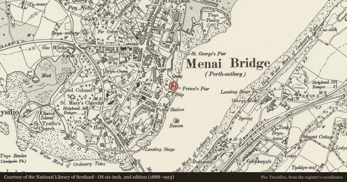
Between Porth Daniel and Porth yr Wrach, close to the former warehouse on Water Street, and built around a small rocky promontory.
History
Built c1830 on land included in a crown lease sought by Richard Davies. Davies had already leased land in the area, and had begun to develop what became a significant mercantile and commercial enterprise, including wholesale, timber and shipping. The wharf was at one time sublet to the Dublin Steam Packet Company. A house and warehouse built on the wharf at about the same time have been altered. The water-side crane is clearly shown on the O.S map of 1889.
Exterior
Wharf, comprising battered stone walls to broad wharf area at the end of a small promontory. Rough boulder construction, with dressed stone quoins at angles, reinforced by bolted timber posts. Cast-iron crane on wharf side.
Reason for designation
Listed as a well-preserved wharf dating from the early development of Menai Bridge as a working port and retaining good character in a functional tradition.
Nearby in the register
- WarehousesCommercialunder 1 mi
- St. George's Pier Booking Office and gatesMaritimeunder 1 mi
- Menai Courthouse ChurchReligious, Ritual and Funeraryunder 1 mi
- Former Police StationReligious, Ritual and Funeraryunder 1 mi
Other entries of the same register within about three miles of this one, by straight line.