Cof Cymru: National Historic Assets of Wales · Wales
Railway Bridge
Monmouth, Monmouthshire, Wales
A Grade II listed building in May Hill, Monmouth, Monmouthshire, designated on 10 August 2005.
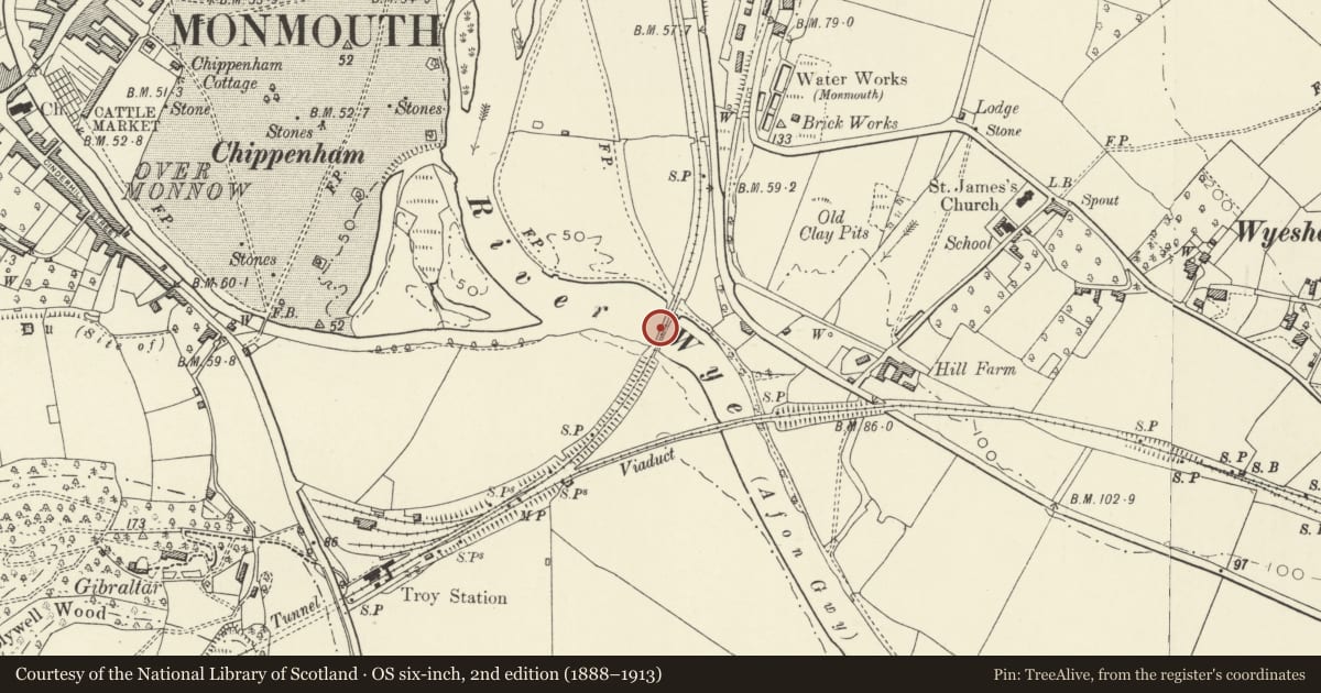
The record
- Designation
- Listed building, Grade II
- Broad class
- Transport
- Date of designation
- 10 August 2005
- Locality
- May Hill
- Town
- Monmouth
- Community
- Monmouth
- Unitary authority
- Monmouthshire
- Country
- Wales
- Coordinates
- 51.80581, -2.70780
- Cadw reference
- 85226
Slide toward Today to fade the historical sheet and see the modern map underneath.
David Rumsey Map Collection, Stanford LibrariesDavid Rumsey Map Collection, Stanford LibrariesDavid Rumsey Map Collection, Stanford LibrariesDavid Rumsey Map Collection, Stanford LibrariesDavid Rumsey Map Collection, Stanford Libraries
5 historical maps cover this location, the earliest the 1636 map "Cornubia : Devonia, Somersetus, Dorcestria, Wiltonia, Glocestria ..." (David Rumsey Map Collection, Stanford Libraries).
Historical maps covering this location
- 1636 · Cornubia : Devonia, Somersetus, Dorcestria, Wiltonia, Glocestria ... (David Rumsey Map Collection, Stanford Libraries)
- 1830 · V.3:11-15:XV.Britisches Reich. A. Kon: England. a. England ab sich: Shire:15-17, 33 (David Rumsey Map Collection, Stanford Libraries)
- 1895 · Sheet 11. Ordnance Survey of England and Wales. (David Rumsey Map Collection, Stanford Libraries)
- 1896 · 233 Monmouth (Hills) (David Rumsey Map Collection, Stanford Libraries)
- 1901 · Sheet 14. (David Rumsey Map Collection, Stanford Libraries)
Cadw's description
Location
About 750m south of Monmouth centre and accessed by footpath.
History
Built in 1874 to carry the Ross and Monmouth Railway over the River Wye to its junction with the Monmouth, Usk and Pontypool Railway at Troy station. It was built by Finch and Co. of Chepstow and designed by their foreman, Mr. Bailiff. The line was closed in 1959 and the bridge now carries a footpath. The bridge remains unaltered apart from the removal of the deck ballast.
Exterior
Constructed wholly of cast and wrought iron apart from the local red sandstone abutments. Three unequal spans supported on pairs of circular cast iron piers, two in the river and two on the west bank. Side spans in panels with wrought iron cross bracing, central bow-string girder also with cross bracing. Deck of arched cast iron plates.
Reason for designation
Included for its special interest as a rare and unaltered all-metal railway bridge of definite character.
Nearby in the register
- The CellReligious, Ritual and Funeraryunder 1 mi
- Milestone '1mile to Monmouth'Transportunder 1 mi
- Church of St. JamesReligious, Ritual and Funeraryunder 1 mi
- Gatepiers and Gates of Church of St. JamesReligious, Ritual and Funeraryunder 1 mi
Other entries of the same register within about three miles of this one, by straight line.