Cof Cymru: National Historic Assets of Wales · Wales
Old Inn Cottage
Monmouth, Monmouthshire, Wales
A Grade II listed building in Buckholt, Monmouth, Monmouthshire, designated on 10 August 2005.
The record
- Designation
- Listed building, Grade II
- Broad class
- No class recorded
- Date of designation
- 10 August 2005
- Locality
- Buckholt
- Town
- Monmouth
- Community
- Monmouth
- Unitary authority
- Monmouthshire
- Country
- Wales
- Coordinates
- 51.83202, -2.71443
- Cadw reference
- 85183
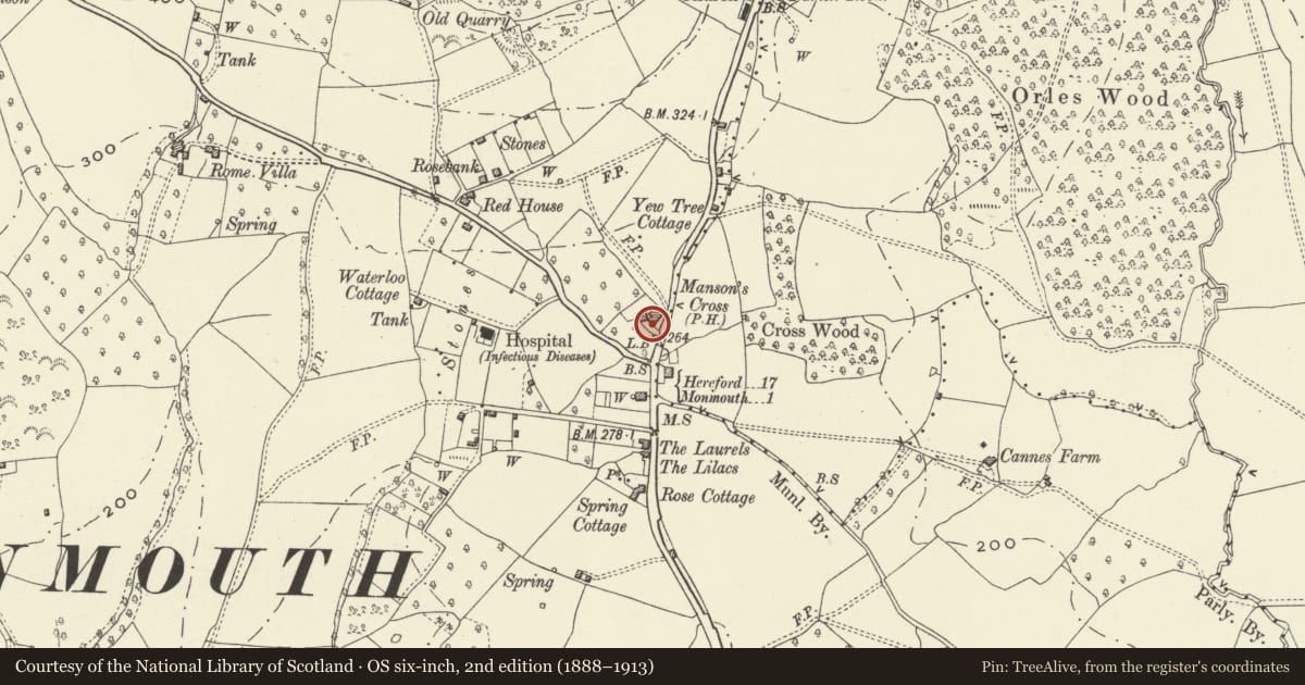
Slide toward Today to fade the historical sheet and see the modern map underneath.
David Rumsey Map Collection, Stanford LibrariesDavid Rumsey Map Collection, Stanford LibrariesDavid Rumsey Map Collection, Stanford LibrariesDavid Rumsey Map Collection, Stanford LibrariesDavid Rumsey Map Collection, Stanford Libraries
5 historical maps cover this location, the earliest the 1636 map "Cornubia : Devonia, Somersetus, Dorcestria, Wiltonia, Glocestria ..." (David Rumsey Map Collection, Stanford Libraries).
Historical maps covering this location
- 1636 · Cornubia : Devonia, Somersetus, Dorcestria, Wiltonia, Glocestria ... (David Rumsey Map Collection, Stanford Libraries)
- 1830 · V.3:11-15:XV.Britisches Reich. A. Kon: England. a. England ab sich: Shire:15-17, 33 (David Rumsey Map Collection, Stanford Libraries)
- 1895 · Sheet 11. Ordnance Survey of England and Wales. (David Rumsey Map Collection, Stanford Libraries)
- 1896 · 233 Monmouth (Hills) (David Rumsey Map Collection, Stanford Libraries)
- 1901 · Sheet 14. (David Rumsey Map Collection, Stanford Libraries)
Cadw's description
Location
On the main road going north out of Monmouth which rises slowly above the town.
History
Possibly late C17 in origin and refurbished as dated 1755 PJE on plaque. Probably a part of the adjoining The Manson Inn until it closed in c1965. The initials are said to refer to the brother of Philip Endale who opened the inn in the C18.
Exterior
Wholly rendered and painted, probably over rubble stone, with a Welsh slate roof. Single depth central entry plan with a continuous outshut on the rear elevation. Two storeys and attic, two windows. Door not seen. Windows are cross-framed casements in elliptical heads. Central plaque under eaves inscribed 1755 PJE. Fairly steeply pitched roof with stack on gable and on junction with adjoining house.
Left return has a lean-to addition on the gable wall.
Rear elevation has long catslide roof coming low over the single storey outshut. Modern features, two rooflights in attic.
Interior
Interior not seen at resurvey.
Reason for designation
Included for its special architectural interest as one of a pair of small Georgian houses on the outskirts of Monmouth.
Nearby in the register
- Hen-dafaronDomesticunder 1 mi
- The MazeDomesticunder 1 mi
- Buckholt Neolithic EnclosureEnclosureunder 1 mi
- Buckholt Wood Hilltop EnclosureEnclosureunder 1 mi
Other entries of the same register within about three miles of this one, by straight line.