Cof Cymru: National Historic Assets of Wales · Wales
Brecon House
Monmouth, Monmouthshire, Wales
A Grade II listed building in Monmouth, Monmouthshire, designated on 10 August 2005.
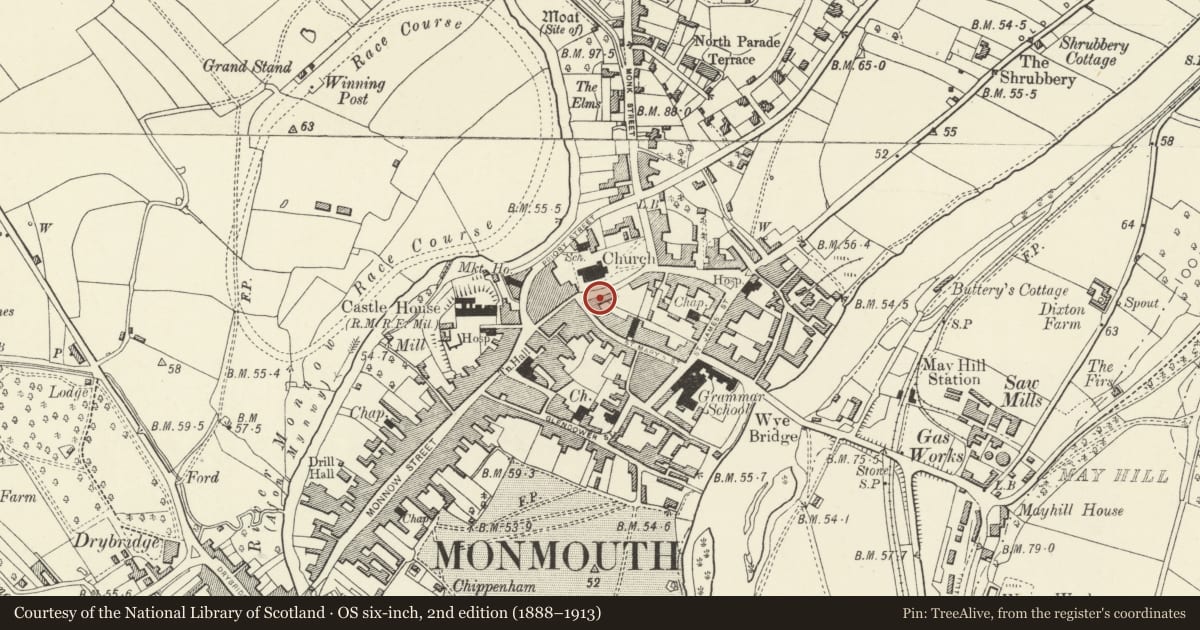
The record
- Designation
- Listed building, Grade II
- Broad class
- Domestic
- Date of designation
- 10 August 2005
- Locality
- Monmouth
- Town
- Monmouth
- Community
- Monmouth
- Unitary authority
- Monmouthshire
- Country
- Wales
- Coordinates
- 51.81282, -2.71380
- Cadw reference
- 85161
Slide toward Today to fade the historical sheet and see the modern map underneath.
David Rumsey Map Collection, Stanford LibrariesDavid Rumsey Map Collection, Stanford LibrariesDavid Rumsey Map Collection, Stanford LibrariesDavid Rumsey Map Collection, Stanford LibrariesDavid Rumsey Map Collection, Stanford Libraries
5 historical maps cover this location, the earliest the 1636 map "Cornubia : Devonia, Somersetus, Dorcestria, Wiltonia, Glocestria ..." (David Rumsey Map Collection, Stanford Libraries).
Historical maps covering this location
- 1636 · Cornubia : Devonia, Somersetus, Dorcestria, Wiltonia, Glocestria ... (David Rumsey Map Collection, Stanford Libraries)
- 1830 · V.3:11-15:XV.Britisches Reich. A. Kon: England. a. England ab sich: Shire:15-17, 33 (David Rumsey Map Collection, Stanford Libraries)
- 1895 · Sheet 11. Ordnance Survey of England and Wales. (David Rumsey Map Collection, Stanford Libraries)
- 1896 · 233 Monmouth (Hills) (David Rumsey Map Collection, Stanford Libraries)
- 1901 · Sheet 14. (David Rumsey Map Collection, Stanford Libraries)
Cadw's description
Location
On the street continuing Church Street east out of the town centre.
History
Early C18 house pair, probably c1725, with alterations in c1900.
Exterior
Doorway with late C20 panelled door with integral fanlight, transom light, flat hood on shaped brackets. Windows are all plate glass sashes in unaltered openings except top floor ones which are 3 over 6 pane sashes with one 2 over 4.
The rear elevation as a ground floor extension, C20 casement windows and a sloping topped dormer.
Interior
The narrow half bay to the right of the door holds the early C18 stair with straight flights, closed string, turned balusters, square newel, moulded handrail and dado panelling opposite. Other contemporary joinery includes dado panelling, a keyed archway in the hall and a shell head cupboard with shaped shelves; there are also 2-panel doors and early C18 floorboards. The interior has also been fairly altered at various times.
Reason for designation
Included for its special architectural interest as one of an early C18 pair of houses of definite character which is part of the important group of historic buildings near St. Mary's Church.
Nearby in the register
- 5 Whitecross StreetNo class recordedunder 1 mi
- 9 Whitecross StreetNo class recordedunder 1 mi
- 3 Whitecross StreetDomesticunder 1 mi
- Dresden HouseNo class recordedunder 1 mi
Other entries of the same register within about three miles of this one, by straight line.