Cof Cymru: National Historic Assets of Wales · Wales
13 Monnow Street
Monmouth, Monmouthshire, Wales
A Grade II listed building in Monmouth, Monmouthshire, designated on 10 August 2005.
The record
- Designation
- Listed building, Grade II
- Broad class
- Domestic
- Date of designation
- 10 August 2005
- Locality
- Monmouth
- Town
- Monmouth
- Community
- Monmouth
- Unitary authority
- Monmouthshire
- Country
- Wales
- Coordinates
- 51.81167, -2.71649
- Cadw reference
- 85027
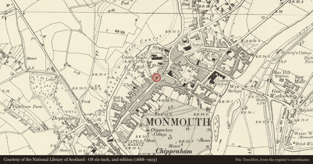
Slide toward Today to fade the historical sheet and see the modern map underneath.
David Rumsey Map Collection, Stanford LibrariesDavid Rumsey Map Collection, Stanford LibrariesDavid Rumsey Map Collection, Stanford LibrariesDavid Rumsey Map Collection, Stanford LibrariesDavid Rumsey Map Collection, Stanford Libraries
5 historical maps cover this location, the earliest the 1636 map "Cornubia : Devonia, Somersetus, Dorcestria, Wiltonia, Glocestria ..." (David Rumsey Map Collection, Stanford Libraries).
Historical maps covering this location
- 1636 · Cornubia : Devonia, Somersetus, Dorcestria, Wiltonia, Glocestria ... (David Rumsey Map Collection, Stanford Libraries)
- 1830 · V.3:11-15:XV.Britisches Reich. A. Kon: England. a. England ab sich: Shire:15-17, 33 (David Rumsey Map Collection, Stanford Libraries)
- 1895 · Sheet 11. Ordnance Survey of England and Wales. (David Rumsey Map Collection, Stanford Libraries)
- 1896 · 233 Monmouth (Hills) (David Rumsey Map Collection, Stanford Libraries)
- 1901 · Sheet 14. (David Rumsey Map Collection, Stanford Libraries)
Cadw's description
Location
On Monmouth's principal commercial street which leads out of the town square going south-west to Monnow Bridge.
History
Built as a house in c1730, with the shopfront added in the late C19.
Exterior
Rendered and painted, probably over brick, roof not visible from the street. Double depth plan with a rear wing. Three storeys, three windows. Ground floor has a good late C19 shopfront with a double window flanked by the shop entrance on the right and an archway giving access to the office premises above to the left. Plain pilasters and fascia, the fascia is broken by the apron of the central first floor oriel. This has a 4 over 4 pane sash flanked by curved 2 over 2 pane ones. Dentil cornice to the top of the window. The upper floors are framed by Tuscan pilasters, a moulded floor band and a cornice above. The oriel is flanked by arched 4 over 4 pane sashes with keyed and imposted surrounds; the upper floor has three similar but smaller windows with the centre one set slightly forward. This set forward is also expressed in the heavily moulded cornice. Rear elevation altered.
Interior
The interior has been extensively altered in its conversion to offices in the C20 but it retains some early C19 joinery and plasterwork, particularly in the main first floor front room. Curved stair with turned balusters and a mahogany handrail.
Reason for designation
Included for its special architectural interest as a multi-period building, having strong group value in Monnow Street.
Nearby in the register
- 5 Monnow StreetCommercialunder 1 mi
- 12 Monnow StreetNo class recordedunder 1 mi
- 14 Monnow StreetCommercialunder 1 mi
- 16 Monnow StreetCommercialunder 1 mi
Other entries of the same register within about three miles of this one, by straight line.