Cof Cymru: National Historic Assets of Wales · Wales
War Memorial at Monmouth Boys School
Monmouth, Monmouthshire, Wales
A Grade II listed building in Monmouth, Monmouthshire, designated on 10 August 2005.
The record
- Designation
- Listed building, Grade II
- Broad class
- Commemorative
- Date of designation
- 10 August 2005
- Locality
- Monmouth
- Town
- Monmouth
- Community
- Monmouth
- Unitary authority
- Monmouthshire
- Country
- Wales
- Coordinates
- 51.81153, -2.71174
- Cadw reference
- 85009
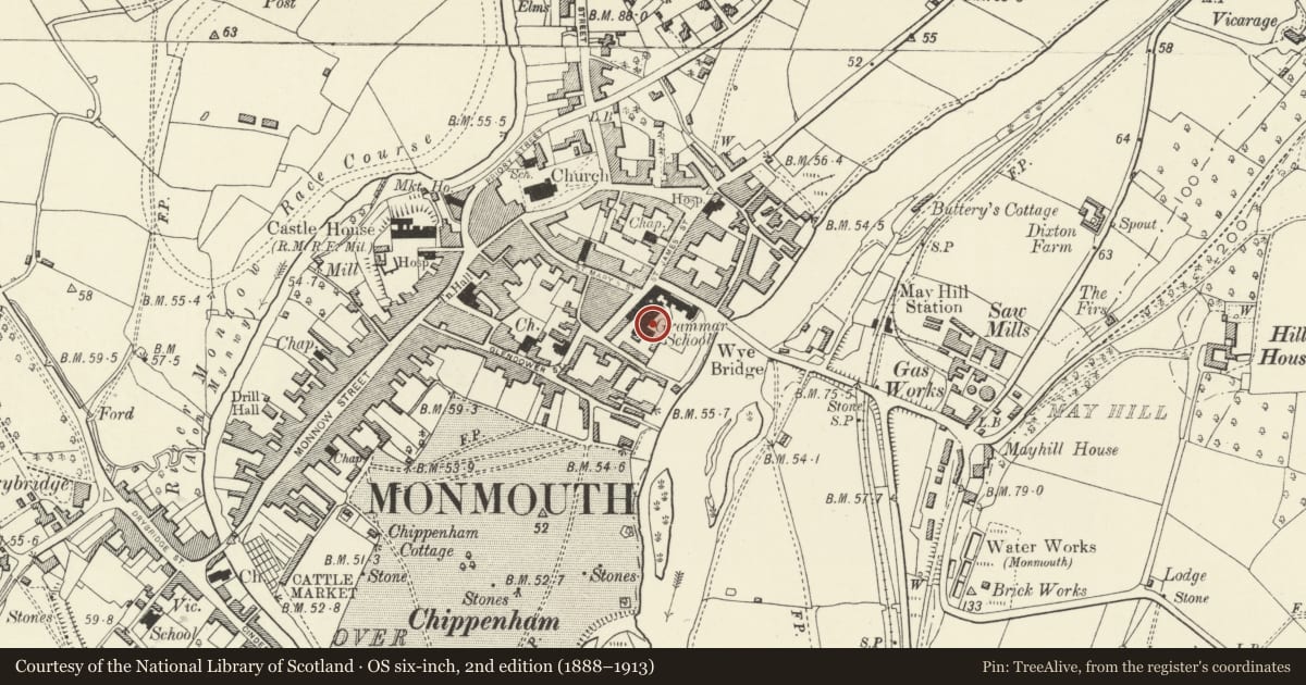
Slide toward Today to fade the historical sheet and see the modern map underneath.
David Rumsey Map Collection, Stanford LibrariesDavid Rumsey Map Collection, Stanford LibrariesDavid Rumsey Map Collection, Stanford LibrariesDavid Rumsey Map Collection, Stanford LibrariesDavid Rumsey Map Collection, Stanford Libraries
5 historical maps cover this location, the earliest the 1636 map "Cornubia : Devonia, Somersetus, Dorcestria, Wiltonia, Glocestria ..." (David Rumsey Map Collection, Stanford Libraries).
Historical maps covering this location
- 1636 · Cornubia : Devonia, Somersetus, Dorcestria, Wiltonia, Glocestria ... (David Rumsey Map Collection, Stanford Libraries)
- 1830 · V.3:11-15:XV.Britisches Reich. A. Kon: England. a. England ab sich: Shire:15-17, 33 (David Rumsey Map Collection, Stanford Libraries)
- 1895 · Sheet 11. Ordnance Survey of England and Wales. (David Rumsey Map Collection, Stanford Libraries)
- 1896 · 233 Monmouth (Hills) (David Rumsey Map Collection, Stanford Libraries)
- 1901 · Sheet 14. (David Rumsey Map Collection, Stanford Libraries)
Cadw's description
Location
In a group in between the town centre and the River Wye in the internal quadrangle of Monmouth School.
History
c1920 and erected as a memorial to the fallen of WWI.
Exterior
Constructed of grey Cornish granite and designed as a combination of a late medieval preaching cross and an Elizabethan sundial. Three square diminishing steps carry a plinth inscribed with the names of the fallen, This has a flat coping and a square socket stone also inscribed. A circular shaft with base mould and cap carries a panelled block like a sundial. This also has a coping and is capped by a pyramid, a ball and a cross.
Reason for designation
Included as a War Memorial in the Monmouth town centre and for its additional historic interest as a part of an important town grammar school.
Nearby in the register
- Block between the Library and the Almshouses including the William Jones Room, Monmouth Boys SchoolNo class recordedunder 1 mi
- Chapel and Library, Monmouth Boys SchoolReligious, Ritual and Funeraryunder 1 mi
- Day Houses and School House, Monmouth Boys SchoolEducationunder 1 mi
- Jones Almshouses (part of Monmouth Boys School)Health and Welfareunder 1 mi
Other entries of the same register within about three miles of this one, by straight line.