Cof Cymru: National Historic Assets of Wales · Wales
No 62 and forecourt railings
Pembroke, Pembrokeshire, Wales
A Grade II listed building in Pembroke, Pembrokeshire, designated on 29 July 2005.
The record
- Designation
- Listed building, Grade II
- Broad class
- Commercial
- Date of designation
- 29 July 2005
- Locality
- Pembroke
- Town
- Pembroke
- Community
- Pembroke
- Unitary authority
- Pembrokeshire
- Country
- Wales
- Coordinates
- 51.67545, -4.91491
- Cadw reference
- 84975
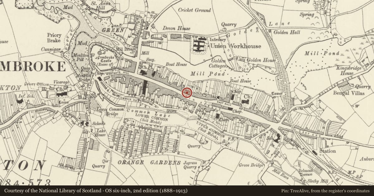
Slide toward Today to fade the historical sheet and see the modern map underneath.
David Rumsey Map Collection, Stanford LibrariesDavid Rumsey Map Collection, Stanford LibrariesDavid Rumsey Map Collection, Stanford LibrariesDavid Rumsey Map Collection, Stanford LibrariesDavid Rumsey Map Collection, Stanford Libraries
5 historical maps cover this location, the earliest the 1636 map "Cornubia : Devonia, Somersetus, Dorcestria, Wiltonia, Glocestria ..." (David Rumsey Map Collection, Stanford Libraries).
Historical maps covering this location
- 1636 · Cornubia : Devonia, Somersetus, Dorcestria, Wiltonia, Glocestria ... (David Rumsey Map Collection, Stanford Libraries)
- 1865 · England and Wales. England No. 6. (David Rumsey Map Collection, Stanford Libraries)
- 1891 · Sheet 10. Ordnance Survey of England and Wales. . (David Rumsey Map Collection, Stanford Libraries)
- 1898 · 245 Pembroke (Hills) (David Rumsey Map Collection, Stanford Libraries)
- 1901 · Sheet 13. (David Rumsey Map Collection, Stanford Libraries)
Cadw's description
Location
On the N side of Main Street some 100m W of its junction with East Back.
History
Late C18 to early C19 terraced town house, in 2004 Heron Crafts shop with accommodation over. Early C20 photograph shows roughcast cladding and no stucco surrounds to openings.
Exterior
Terraced house standing forward of No 62 to left. Painted stucco with slate roof and C20 renewed boxed eaves over brick dentils. No chimneys. Three storeys, three-window range with raised shouldered surrounds to openings and painted slate sills. Square horned 6-pane sashes to top floor, horned 12-pane sashes to first floor and sashes with marginal glazing bars to upper sash only to ground floor. Centre recessed 4-panel door. Slate sills to upper floors, stone to ground floor. Short section of left end wall visible in front of No 62
Forecourt has rails on tooled limestone coping., set on stuccoed wall, rising to some 1.5 m due to slope of ground, low stuccoed base to right. Centre three slate-capped steps. Rails are wrought iron spearheaded with cast-iron anthemion finials to stanchions. Scrolled ends to gate uprights, wrought-iron gate.
Interior
Ground floor only partially inspected. Altered as shop, staircase at right angles behind W room not inspected. C19 cornice in E room.
Reason for designation
Included as a substantial late Georgian town house in a prominent position at the beginning of the Chain Back.
Nearby in the register
- 64 & 66 & 68 Main Street including forecourt gatepiers and railingsDomesticunder 1 mi
- Shaftesbury House, forecourt wall and rails and house to leftCommercialunder 1 mi
- 57 Main StreetDomesticunder 1 mi
- Picton HouseCommercialunder 1 mi
Other entries of the same register within about three miles of this one, by straight line.