Cof Cymru: National Historic Assets of Wales · Wales
Hay's House / Arthur's House
Pembroke, Pembrokeshire, Wales
A Grade II listed building in Pembroke, Pembrokeshire, designated on 29 July 2005.
The record
- Designation
- Listed building, Grade II
- Broad class
- Domestic
- Date of designation
- 29 July 2005
- Locality
- Pembroke
- Town
- Pembroke
- Community
- Pembroke
- Unitary authority
- Pembrokeshire
- Country
- Wales
- Coordinates
- 51.67450, -4.91145
- Cadw reference
- 84974
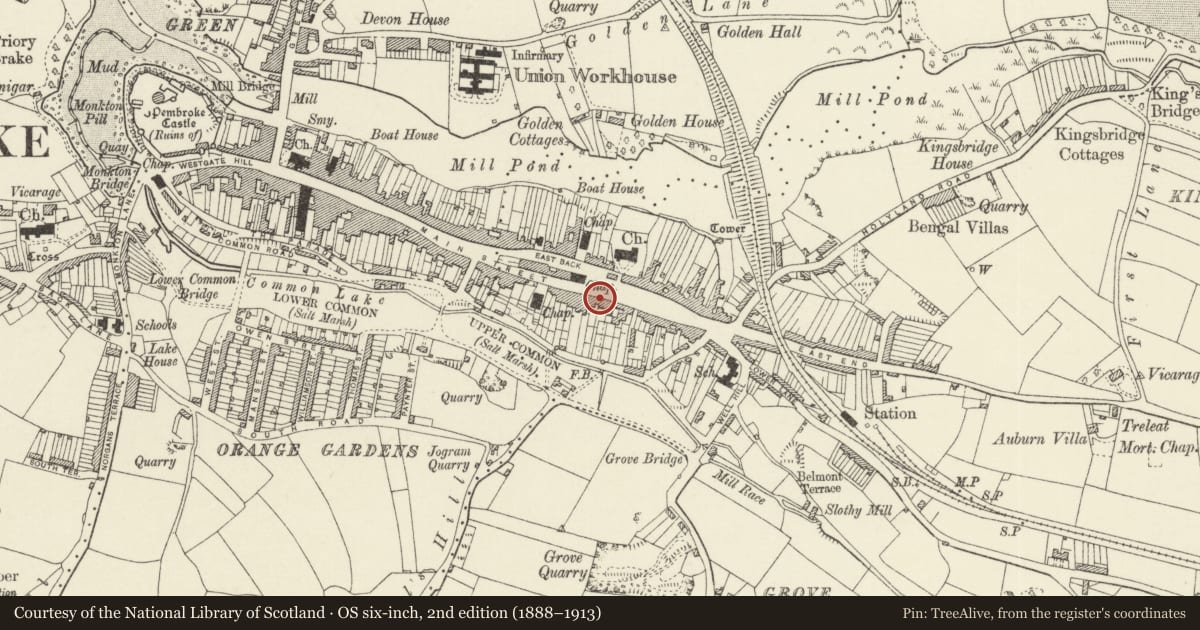
Slide toward Today to fade the historical sheet and see the modern map underneath.
David Rumsey Map Collection, Stanford LibrariesDavid Rumsey Map Collection, Stanford LibrariesDavid Rumsey Map Collection, Stanford LibrariesDavid Rumsey Map Collection, Stanford LibrariesDavid Rumsey Map Collection, Stanford Libraries
5 historical maps cover this location, the earliest the 1636 map "Cornubia : Devonia, Somersetus, Dorcestria, Wiltonia, Glocestria ..." (David Rumsey Map Collection, Stanford Libraries).
Historical maps covering this location
- 1636 · Cornubia : Devonia, Somersetus, Dorcestria, Wiltonia, Glocestria ... (David Rumsey Map Collection, Stanford Libraries)
- 1865 · England and Wales. England No. 6. (David Rumsey Map Collection, Stanford Libraries)
- 1891 · Sheet 10. Ordnance Survey of England and Wales. . (David Rumsey Map Collection, Stanford Libraries)
- 1898 · 245 Pembroke (Hills) (David Rumsey Map Collection, Stanford Libraries)
- 1901 · Sheet 13. (David Rumsey Map Collection, Stanford Libraries)
Cadw's description
Location
On the S side of Main Street opposite its E junction with East Back and next to the Old Cross Saws Inn.
History
House and shop of external C19 character but possibly earlier origins, the roof continuous with the Cross Saws inn adjoining . Converted into two flats c. 2003. Said to have been a hardware shop previously.
Exterior
House and former shop, now two flats, painted stucco with slate roof and small rendered stack to left. Two storeys, three bays with renewed sashes with marginal glazing bars and slate sills to first floor and ground floor right. Centre door and shopfront to left are joined by mid to later C19 stucco pilastered overall surround. Two pilasters frame centre door and third to left of shopfront, with plinths, caps and overall frieze and cornice, broken forward over the pilasters. Centre door (Hay House) has 2 long arched panels and overlight with marginal panes. Shop has recessed half-glazed door (Arthur's House) with overlight to right, shop window to left of 6 panes with 2 further panes canted in to right to door.
Interior
Not inspected.
Reason for designation
Included as a pre-1840 terraced house with good pilastered shopfront, carefully renewed.
Nearby in the register
- 105 Main StreetDomesticunder 1 mi
- Old Cross Saws InnCommercialunder 1 mi
- St OswaldsDomesticunder 1 mi
- Front garden wall, railings, gatepiers & gate to No 111, with penny postage stamp machine to rightDomesticunder 1 mi
Other entries of the same register within about three miles of this one, by straight line.