Cof Cymru: National Historic Assets of Wales · Wales
Cow-shed range at Ty Fry
Llanfrynach, Powys, Wales
A Grade II listed building in Llanfrynach, Brecon, Powys, designated on 28 July 2005.
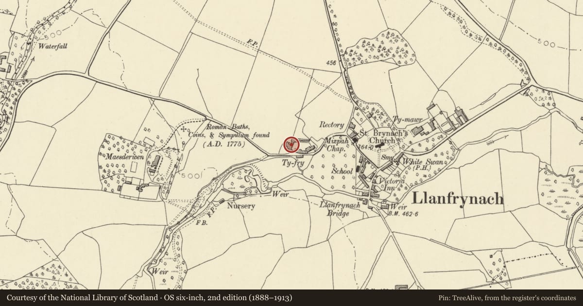
The record
- Designation
- Listed building, Grade II
- Broad class
- Agriculture and Subsistence
- Date of designation
- 28 July 2005
- Locality
- Llanfrynach
- Town
- Brecon
- Community
- Llanfrynach
- Unitary authority
- Powys
- Country
- Wales
- Coordinates
- 51.92295, -3.35007
- Cadw reference
- 84823
Slide toward Today to fade the historical sheet and see the modern map underneath.
David Rumsey Map Collection, Stanford LibrariesDavid Rumsey Map Collection, Stanford LibrariesDavid Rumsey Map Collection, Stanford LibrariesDavid Rumsey Map Collection, Stanford LibrariesDavid Rumsey Map Collection, Stanford Libraries
5 historical maps cover this location, the earliest the 1608 map "(13) Cambriae Typus." (David Rumsey Map Collection, Stanford Libraries).
Historical maps covering this location
- 1608 · (13) Cambriae Typus. (David Rumsey Map Collection, Stanford Libraries)
- 1636 · Cornubia : Devonia, Somersetus, Dorcestria, Wiltonia, Glocestria ... (David Rumsey Map Collection, Stanford Libraries)
- 1856 · 42. Brecon. (David Rumsey Map Collection, Stanford Libraries)
- 1898 · 213 Brecon (Hills) (David Rumsey Map Collection, Stanford Libraries)
- 1901 · Sheet 14. (David Rumsey Map Collection, Stanford Libraries)
Cadw's description
Location
Situated across W end of farmyard at Ty Fry.
History
Outbuilding, late C18 or early C19, comprising a single storey cow-house between two gabled taller cross-wings.
Exterior
Outbuilding, rubble stone with asbestos-sheet roofs. Single storey range with steep roof and nine cambered-headed openings with stone voussoirs, alternately four windows and five narrower doors. The cross-wing to left projects with a cambered-headed loft opening with stone voussoirs in gable end. Plank door with cover strips to ground floor right, with concrete lintel, and blocked window left of centre. Side wall in angle to cow shed has outside steps to loft door. Opposite right crosswing also has outside steps to loft door in angle, but gable end is open with corrugated sheet cladding to upper part.
Reason for designation
Included as part of a large farmyard group of definite regional character at Ty Fry of C18 to C19 dates.
Nearby in the register
- Barn range at Ty FryAgriculture and Subsistenceunder 1 mi
- Ty FryDomesticunder 1 mi
- Jefferys Wilkins memorial in churchyardReligious, Ritual and Funeraryunder 1 mi
- Early Medieval Cross in St Brynach’s Church, LlanfrynachCrossunder 1 mi
Other entries of the same register within about three miles of this one, by straight line.