Cof Cymru: National Historic Assets of Wales · Wales
Wall, gates and gate piers on the E side of Beaumaris churchyard
Beaumaris, Isle of Anglesey, Wales
A Grade II listed building in Beaumaris, Isle of Anglesey, designated on 13 July 2005.
The record
- Designation
- Listed building, Grade II
- Broad class
- No class recorded
- Date of designation
- 13 July 2005
- Locality
- Beaumaris
- Town
- Beaumaris
- Community
- Beaumaris
- Unitary authority
- Isle of Anglesey
- Country
- Wales
- Coordinates
- 53.26391, -4.09376
- Cadw reference
- 84797
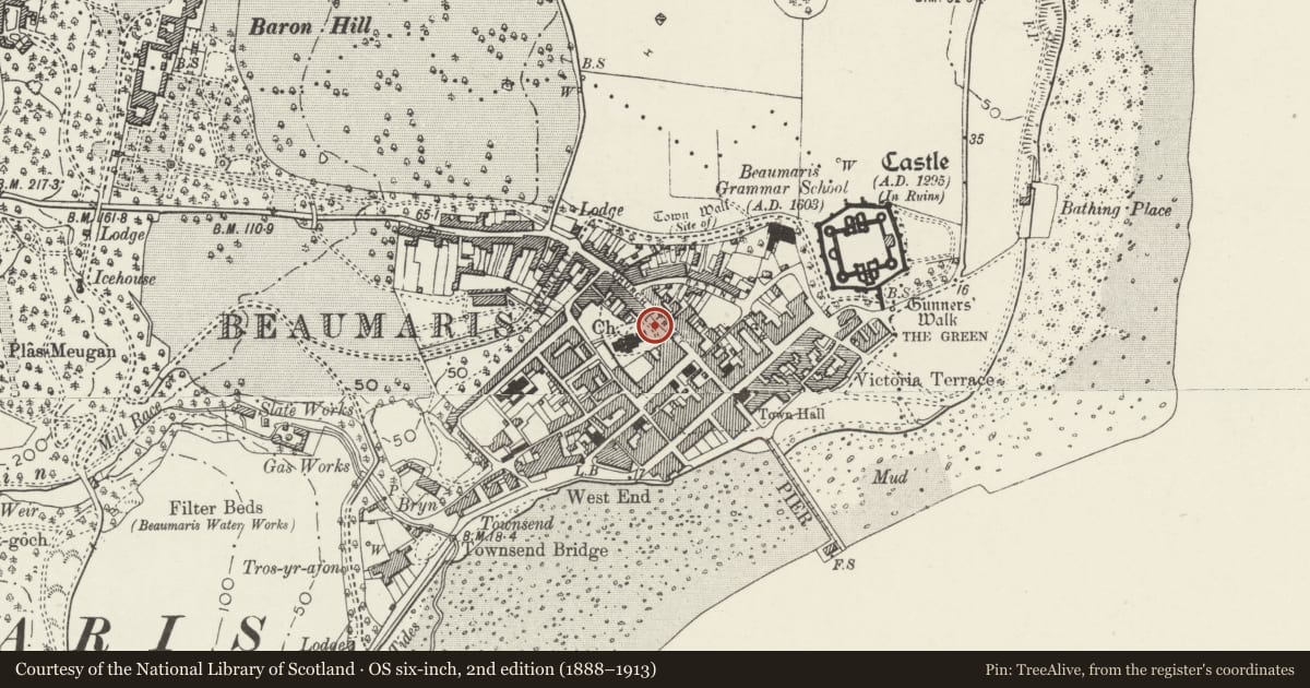
Slide toward Today to fade the historical sheet and see the modern map underneath.
David Rumsey Map Collection, Stanford LibrariesDavid Rumsey Map Collection, Stanford LibrariesDavid Rumsey Map Collection, Stanford LibrariesDavid Rumsey Map Collection, Stanford LibrariesDavid Rumsey Map Collection, Stanford Libraries
5 historical maps cover this location, the earliest the 1883 map "Watershed map England, Wales 3." (David Rumsey Map Collection, Stanford Libraries).
Historical maps covering this location
- 1883 · Watershed map England, Wales 3. (David Rumsey Map Collection, Stanford Libraries)
- 1896 · Sheet 7. Ordnance Survey of England and Wales. (David Rumsey Map Collection, Stanford Libraries)
- 1899 · 94 Beaumaris (Hills) (David Rumsey Map Collection, Stanford Libraries)
- 1901 · Sheet 9 and 10. (David Rumsey Map Collection, Stanford Libraries)
- 1919 · Sheet 41. Anglesey. (David Rumsey Map Collection, Stanford Libraries)
Cadw's description
Location
On the E side of the churchyard.
History
C19 churchyard wall with C20 modification to accommodate the war memorial, and replacement C20 gates.
Exterior
A rubble-stone revetment wall with freestone coping and iron railings. In the centre are 2 freestone square piers with moulded caps, which frame a recess housing the war memorial, and between which is a lower wall with concrete coping and modern railings. At each end are square freestone gate piers with pyramidal caps, and with stone steps at the S end. In the double cast iron S gates the lock rail incorporates panels with, in raised letters, 'JER 1938-76'. The double cast iron N gates incorporate 'ARG 1957' in the lock rail.
Reason for designation
Listed for its special interest as a C19 wall and gateways that contribute to the setting of the church and to the historical integrity of Church Street.
Nearby in the register
- Beaumaris War MemorialNo class recordedunder 1 mi
- Squirrel CottageDomesticunder 1 mi
- Church BankDomesticunder 1 mi
- 24 Church StreetCommercialunder 1 mi
Other entries of the same register within about three miles of this one, by straight line.