Cof Cymru: National Historic Assets of Wales · Wales
Bay House, including forecourt railings and gate
Beaumaris, Isle of Anglesey, Wales
A Grade II listed building in Beaumaris, Isle of Anglesey, designated on 13 July 2005.
The record
- Designation
- Listed building, Grade II
- Broad class
- No class recorded
- Date of designation
- 13 July 2005
- Locality
- Beaumaris
- Town
- Beaumaris
- Community
- Beaumaris
- Unitary authority
- Isle of Anglesey
- Country
- Wales
- Coordinates
- 53.26228, -4.09354
- Cadw reference
- 84755
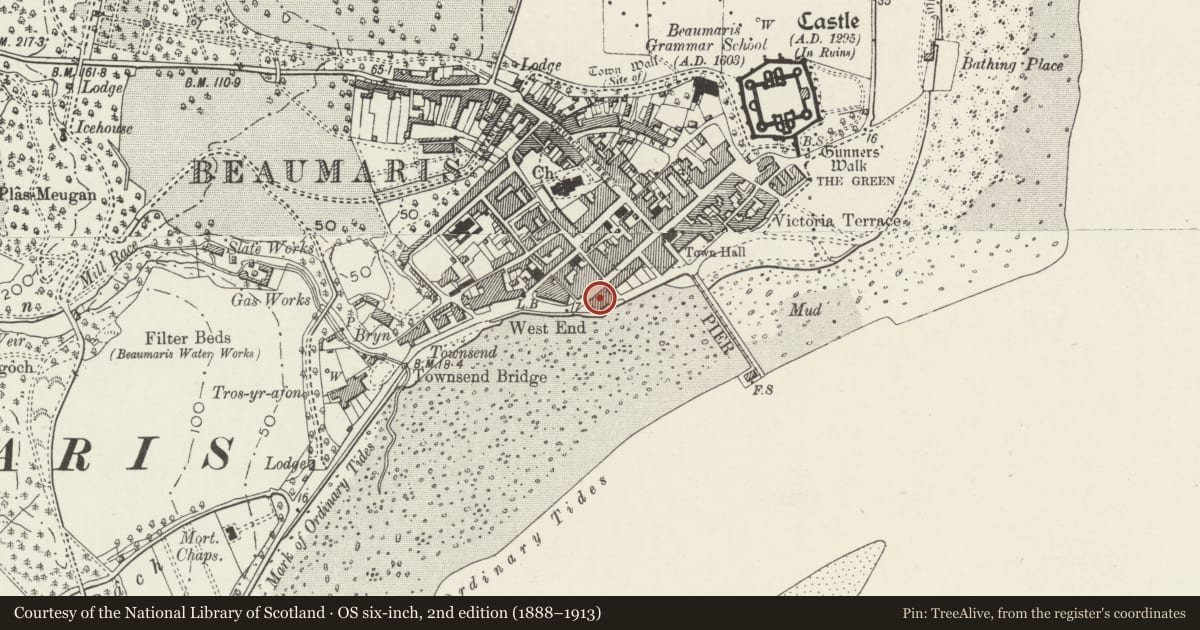
Slide toward Today to fade the historical sheet and see the modern map underneath.
David Rumsey Map Collection, Stanford LibrariesDavid Rumsey Map Collection, Stanford LibrariesDavid Rumsey Map Collection, Stanford LibrariesDavid Rumsey Map Collection, Stanford LibrariesDavid Rumsey Map Collection, Stanford Libraries
5 historical maps cover this location, the earliest the 1883 map "Watershed map England, Wales 3." (David Rumsey Map Collection, Stanford Libraries).
Historical maps covering this location
- 1883 · Watershed map England, Wales 3. (David Rumsey Map Collection, Stanford Libraries)
- 1896 · Sheet 7. Ordnance Survey of England and Wales. (David Rumsey Map Collection, Stanford Libraries)
- 1899 · 94 Beaumaris (Hills) (David Rumsey Map Collection, Stanford Libraries)
- 1901 · Sheet 9 and 10. (David Rumsey Map Collection, Stanford Libraries)
- 1919 · Sheet 41. Anglesey. (David Rumsey Map Collection, Stanford Libraries)
Cadw's description
Location
Set back from the road near the SW end of the street.
History
One of a pair of houses built by the Baron Hill estate in the late C19 on the site of the former public baths, and shown on the 1889 Ordnance Survey and 1892 estate plan.
Exterior
Belongs to a group of 47-49 Castle Street.
A reflected pair of 2-bay houses of 2 storeys with attics and basement, of rendered front, with channelled rustication in the lower storey, and mansard slate roofs on a moulded eaves cornice with 2 stacks on each end. Entrances are to the inner bays and have panelled doors with plain overlights, under canopies on deep corbels. Outer bays have 4-pane sash windows under keyed heads. First-floor windows have a sill band and architraves, which have consoles to stilted and moulded segmental heads with keystones, and 4-pane sashes. The attic, also with a sill band, has gabled half dormers in the outer bays with 4-pane sashes in architraves similar to the first floor windows. The basements have segmental-headed windows. The front retains original cast iron rainwater goods. No 47 also retains original forecourt railings, with spear finials, on a dwarf wall, and iron gate. No 49 has replacement railings.
In the gable ends the pebble-dashed walls are recessed between the stacks.
Interior
Not inspected.
Reason for designation
Listed for its special architectural interest as one of a pair of late C19 town houses of definite quality and character, and for its contribution to the historical integrity of Castle Street.
Nearby in the register
- Craig HyfrydNo class recordedunder 1 mi
- Llys MenaiNo class recordedunder 1 mi
- 1 Alma StreetDomesticunder 1 mi
- 3 Alma StreetNo class recordedunder 1 mi
Other entries of the same register within about three miles of this one, by straight line.