Cof Cymru: National Historic Assets of Wales · Wales
20 Stanley Street
Beaumaris, Isle of Anglesey, Wales
A Grade II listed building in Beaumaris, Isle of Anglesey, designated on 23 September 1950.
The record
- Designation
- Listed building, Grade II
- Broad class
- No class recorded
- Date of designation
- 23 September 1950
- Locality
- Beaumaris
- Town
- Beaumaris
- Community
- Beaumaris
- Unitary authority
- Isle of Anglesey
- Country
- Wales
- Coordinates
- 53.26467, -4.09574
- Cadw reference
- 84707
Slide toward Today to fade the historical sheet and see the modern map underneath.
David Rumsey Map Collection, Stanford LibrariesDavid Rumsey Map Collection, Stanford LibrariesDavid Rumsey Map Collection, Stanford LibrariesDavid Rumsey Map Collection, Stanford LibrariesDavid Rumsey Map Collection, Stanford Libraries
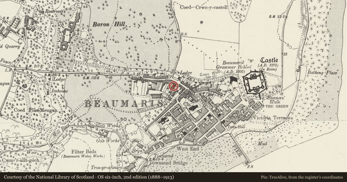
5 historical maps cover this location, the earliest the 1883 map "Watershed map England, Wales 3." (David Rumsey Map Collection, Stanford Libraries).
Historical maps covering this location
- 1883 · Watershed map England, Wales 3. (David Rumsey Map Collection, Stanford Libraries)
- 1896 · Sheet 7. Ordnance Survey of England and Wales. (David Rumsey Map Collection, Stanford Libraries)
- 1899 · 94 Beaumaris (Hills) (David Rumsey Map Collection, Stanford Libraries)
- 1901 · Sheet 9 and 10. (David Rumsey Map Collection, Stanford Libraries)
- 1919 · Sheet 41. Anglesey. (David Rumsey Map Collection, Stanford Libraries)
Cadw's description
Location
In a row of houses fronting the street.
History
Stanley Street comprises mid C19 Baron Hill estate terraced houses shown on the 1861 town plan. The street formed an ordered approach to one of the main entrances to Baron Hill.
Exterior
Belongs to a group of 13-23 Stanley Street and 9 Wexham Street.
A terrace of 2-storey brick houses, with slate roof and brick stacks. Windows have dressed limestone surrounds with monolithic jambs, and round heads with keystones in the lower storey. Two-light windows have wooden mullions and small-pane casements, and transoms in the lower storey. The houses are built in pairs of 3 bays, of which the central bay has a passage through a plain round brick arch, leading to the boarded front doors, and to the back yards. The central bay, above the passage, also has a window. At the R-hand end, the passage leads to No 23 and to the yard behind 9 Wexham Street. The 3-window Wexham Street return elevation has a boarded door under a round-headed overlight and plain brick arch. The upper L-hand window is blocked. A window was inserted in the C20 at the R end.
The L gable end of No 13 is roughcast. The rear has small-pane horizontal-sliding sashes.
Interior
Not inspected.
Reason for designation
Nos 1-11 and 13-23 Stanley Street and 9 Wexham Street are listed for their special architectural interest as well-preserved mid C19 estate terraced houses of definite quality and character, a major element in one of the former main approaches to Baron Hill, and for their overall contribution to the historical integrity of Wexham Street.
Nearby in the register
- 21 Stanley StreetNo class recordedunder 1 mi
- 19 Stanley StreetNo class recordedunder 1 mi
- 22 Stanley StreetNo class recordedunder 1 mi
- 18 Stanley StreetNo class recordedunder 1 mi
Other entries of the same register within about three miles of this one, by straight line.