Cof Cymru: National Historic Assets of Wales · Wales
2 Steeple Lane (52a Castle St)
Beaumaris, Isle of Anglesey, Wales
A Grade II listed building in Beaumaris, Isle of Anglesey, designated on 13 July 2005.
The record
- Designation
- Listed building, Grade II
- Broad class
- No class recorded
- Date of designation
- 13 July 2005
- Locality
- Beaumaris
- Town
- Beaumaris
- Community
- Beaumaris
- Unitary authority
- Isle of Anglesey
- Country
- Wales
- Coordinates
- 53.26260, -4.09346
- Cadw reference
- 84701
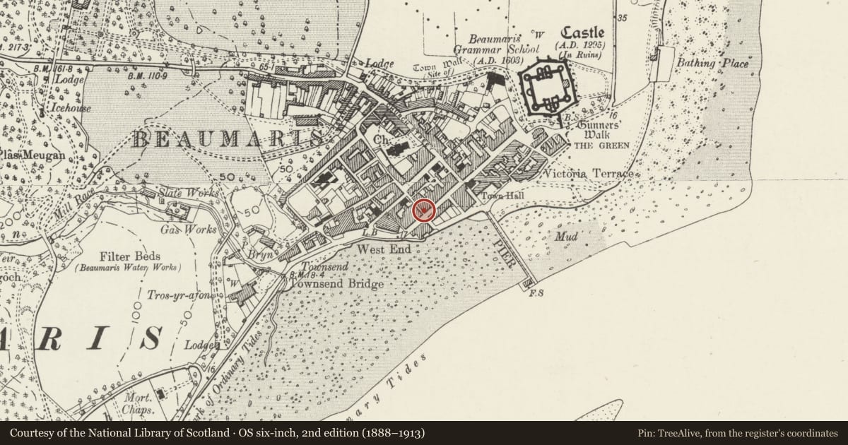
Slide toward Today to fade the historical sheet and see the modern map underneath.
David Rumsey Map Collection, Stanford LibrariesDavid Rumsey Map Collection, Stanford LibrariesDavid Rumsey Map Collection, Stanford LibrariesDavid Rumsey Map Collection, Stanford LibrariesDavid Rumsey Map Collection, Stanford Libraries
5 historical maps cover this location, the earliest the 1883 map "Watershed map England, Wales 3." (David Rumsey Map Collection, Stanford Libraries).
Historical maps covering this location
- 1883 · Watershed map England, Wales 3. (David Rumsey Map Collection, Stanford Libraries)
- 1896 · Sheet 7. Ordnance Survey of England and Wales. (David Rumsey Map Collection, Stanford Libraries)
- 1899 · 94 Beaumaris (Hills) (David Rumsey Map Collection, Stanford Libraries)
- 1901 · Sheet 9 and 10. (David Rumsey Map Collection, Stanford Libraries)
- 1919 · Sheet 41. Anglesey. (David Rumsey Map Collection, Stanford Libraries)
Cadw's description
Location
On the corner of Steeple Lane and Castle Street and part of a short terrace with Nos 50-52 Castle Street.
History
Probably built in the early 1860s, being similar in style and materials to Bulkeley Terrace, Raglan Street and Alma Street of that date, and first shown on the 1889 Ordnance Survey.
Exterior
Belongs to a group of 50-52 Castle Street and 2 Steeple Lane.
A short late-Georgian style terrace of three 3-storey houses on a corner site, which have pebble-dashed walls on a freestone plinth and with ashlar quoins, and slate roof with roughcast, brick and pebble-dashed stacks. Nos 50 and 52 Castle Street are 2-bay houses with the entrance in the L-hand bay, above which are blind windows. No 50 to the R has a moulded doorcase with a recessed door of 2 round-headed panels and an overlight. To its R is a 12-pane horned sash window beneath an entablature with dentilled cornice. In the middle storey is a 2-light oriel window. Other windows have smooth-rendered architraves and raised bands. The upper storey has a 9-pane sash window. No 52 has a painted freestone surround to a 6-panel door and plain overlight. Windows have moulded architraves and are 12-pane hornless sashes in the lower and middle storeys, with a shorter 9-pane sash in the upper storey.
No 2 Steeple Lane has a single bay facing Castle Street. It has a 12-pane hornless sash window in the lower storey, 2-light oriel in the middle storey and shorter 9-pane hornless sash window in the upper storey. The Steeple Lane elevation has a 4-panel door and 12-pane hornless sash window to its L. A replacement stair window is upper L.
The rear of No 2 Steeple Lane has small sash windows above a single-storey lean-to. 52 Castle Street has hornless small-pane and replacement sashes. No 50 Castle Street has an added rear wing.
Interior
Not inspected.
Reason for designation
Listed for its special architectural interest as part of a terrace of definite C19 quality and character, and for its contribution to the historical integrity of Castle Street.
Nearby in the register
- 52 Castle StreetNo class recordedunder 1 mi
- 50 Castle StreetDomesticunder 1 mi
- The Gatehouse, including attached section of town wall at the rearDomesticunder 1 mi
- Bishopsgate Hotel & RestaurantDomesticunder 1 mi
Other entries of the same register within about three miles of this one, by straight line.