Cof Cymru: National Historic Assets of Wales · Wales
13 Castle Street
Ruthin, Denbighshire, Wales
A Grade II listed building in Ruthin, Denbighshire, designated on 16 May 1978.
The record
- Designation
- Listed building, Grade II
- Broad class
- Domestic
- Date of designation
- 16 May 1978
- Town
- Ruthin
- Community
- Ruthin
- Unitary authority
- Denbighshire
- Country
- Wales
- Coordinates
- 53.11347, -3.31040
- Cadw reference
- 847
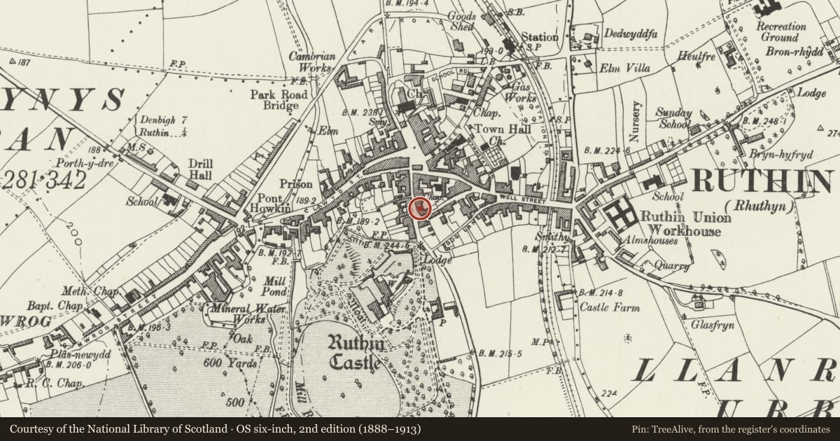
Slide toward Today to fade the historical sheet and see the modern map underneath.
David Rumsey Map Collection, Stanford LibrariesDavid Rumsey Map Collection, Stanford LibrariesLlyfrgell Genedlaethol Cymru – The National Library of WalesDavid Rumsey Map Collection, Stanford LibrariesDavid Rumsey Map Collection, Stanford Libraries
5 historical maps cover this location, the earliest the 1795 map "To Sir Watkin Williams-Wynn Bart ... the map of the six counties of North Wales is most humbly inscribed by his obedient humble servant" (Llyfrgell Genedlaethol Cymru – The National Library of Wales).
Historical maps covering this location
- 1795 · To Sir Watkin Williams-Wynn Bart ... the map of the six counties of North Wales is most… (Llyfrgell Genedlaethol Cymru – The National Library of Wales)
- 1830 · V.3:11-15:XV. Britisches Reich. A. Kon: England. b. Frstenthum Wales: Shire: 37-40 (David Rumsey Map Collection, Stanford Libraries)
- 1883 · Watershed map England, Wales 3. (David Rumsey Map Collection, Stanford Libraries)
- 1898 · 108 Flint (Hills) (David Rumsey Map Collection, Stanford Libraries)
- 1901 · Sheet 9 and 10. (David Rumsey Map Collection, Stanford Libraries)
Cadw's description
Location
Located in a block of buildings on the E side of Castle Street
History
Probably C18-19 remodelling of earlier fabric. An offset at ground floor level may relate to an earlier structure.
Exterior
Two-storey 2-window house, roughcast under a slate roof with large stack to rear, possibly on wing. Entrance offset L of centre, with wooden doorcase containing a panelled door with 4-pane overlight; gabled porch canopy with decorative pierced and cusped barge boards and tall finial, supported on curved brackets. To L, double boarded garage doors. To R, late C19 canted bay window with hipped roof and decorated eaves cornice, containing a 4-pane sash. Upper storey has 2 hornless 12-pane sash windows immediately under the eaves.
Interior
Interior not seen.
Reason for designation
Listed as a town-house with early origins, retaining historic character, with good C18-19 detail. Group value with surrounding listed buildings in Castle Street.
Nearby in the register
- 15 Castle StreetDomesticunder 1 mi
- 11 Castle StreetDomesticunder 1 mi
- 1 Record StreetDomesticunder 1 mi
- Plas yn DreNo class recordedunder 1 mi
Other entries of the same register within about three miles of this one, by straight line.