Cof Cymru: National Historic Assets of Wales · Wales
Former coach house and stables at Bod Talog
Tywyn, Gwynedd, Wales
A Grade II listed building in Cwm Maethlon (Happy Valley), Tywyn, Gwynedd, designated on 24 June 2005.
The record
- Designation
- Listed building, Grade II
- Broad class
- No class recorded
- Date of designation
- 24 June 2005
- Locality
- Cwm Maethlon (Happy Valley)
- Community
- Tywyn
- Unitary authority
- Gwynedd
- Country
- Wales
- Coordinates
- 52.57534, -4.06537
- Cadw reference
- 84540
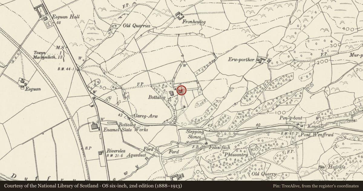
Slide toward Today to fade the historical sheet and see the modern map underneath.
David Rumsey Map Collection, Stanford LibrariesDavid Rumsey Map Collection, Stanford LibrariesLlyfrgell Genedlaethol Cymru – The National Library of WalesDavid Rumsey Map Collection, Stanford LibrariesDavid Rumsey Map Collection, Stanford Libraries
5 historical maps cover this location, the earliest the 1608 map "(13) Cambriae Typus." (David Rumsey Map Collection, Stanford Libraries).
Historical maps covering this location
- 1608 · (13) Cambriae Typus. (David Rumsey Map Collection, Stanford Libraries)
- 1795 · To Sir Watkin Williams-Wynn Bart ... the map of the six counties of North Wales is most… (Llyfrgell Genedlaethol Cymru – The National Library of Wales)
- 1830 · V.3:11-15:XV. Britisches Reich. A. Kon: England. b. Frstenthum Wales: Shire: 37-40 (David Rumsey Map Collection, Stanford Libraries)
- 1883 · Watershed map England, Wales 3. (David Rumsey Map Collection, Stanford Libraries)
- 1896 · Sheet 7. Ordnance Survey of England and Wales. (David Rumsey Map Collection, Stanford Libraries)
Cadw's description
Location
On the E side of the house.
History
Built in the second half of the C19, probably contemporary with the house, and first shown on the 1889 Ordnance Survey.
Exterior
An outbuilding of rubble-stone and slate roof with rear projecting lateral stone stack of which the upper part is rebuilt in brick. It has a central range with gabled wing on the R and a wider cross wing on the L. The central section has a boarded door with overlight on the R side, and 2 replacement windows to its L. Above is a larger replacement window in a gable. The R-hand wing has double boarded doors under a timber lintel and 2-light loft window. The L-hand wing has a boarded door in its side wall facing the small yard, and inserted double doors under a steel lintel. In the gable end original coach doors have been replaced by a single door and glazing. Above it is a replacement loft window. The L side wall has a boarded door, 2 replacement windows and a small inserted window. The cross wing projects behind the central section, to the R of the stack, and has a boarded loft door where the ground level is higher.
Interior
Not inspected.
Reason for designation
Listed for its special architectural interest as an outbuilding retaining definite C19 character, and for its contribution to the historical integrity of the house.
Nearby in the register
- Bod TalogNo class recordedunder 1 mi
- The Cruck Hall at Rhowniar Outward Bound CentreDomesticunder 1 mi
- Rhowniar Outward Bound CentreDomesticunder 1 mi
- Tywyn & District War Memorial HospitalHealth and Welfareunder 1 mi
Other entries of the same register within about three miles of this one, by straight line.