Cof Cymru: National Historic Assets of Wales · Wales
Gatepiers, with flanking walls and railings, to Ffrwdgrech
Glyn Tarell, Powys, Wales
A Grade II listed building in Llanfaes, Brecon, Glyn Tarell, Powys, designated on 22 June 2005.
The record
- Designation
- Listed building, Grade II
- Broad class
- Domestic
- Date of designation
- 22 June 2005
- Locality
- Llanfaes
- Town
- Brecon
- Community
- Glyn Tarell
- Unitary authority
- Powys
- Country
- Wales
- Coordinates
- 51.93616, -3.41389
- Cadw reference
- 84506
Slide toward Today to fade the historical sheet and see the modern map underneath.
David Rumsey Map Collection, Stanford LibrariesDavid Rumsey Map Collection, Stanford LibrariesDavid Rumsey Map Collection, Stanford LibrariesDavid Rumsey Map Collection, Stanford LibrariesDavid Rumsey Map Collection, Stanford Libraries
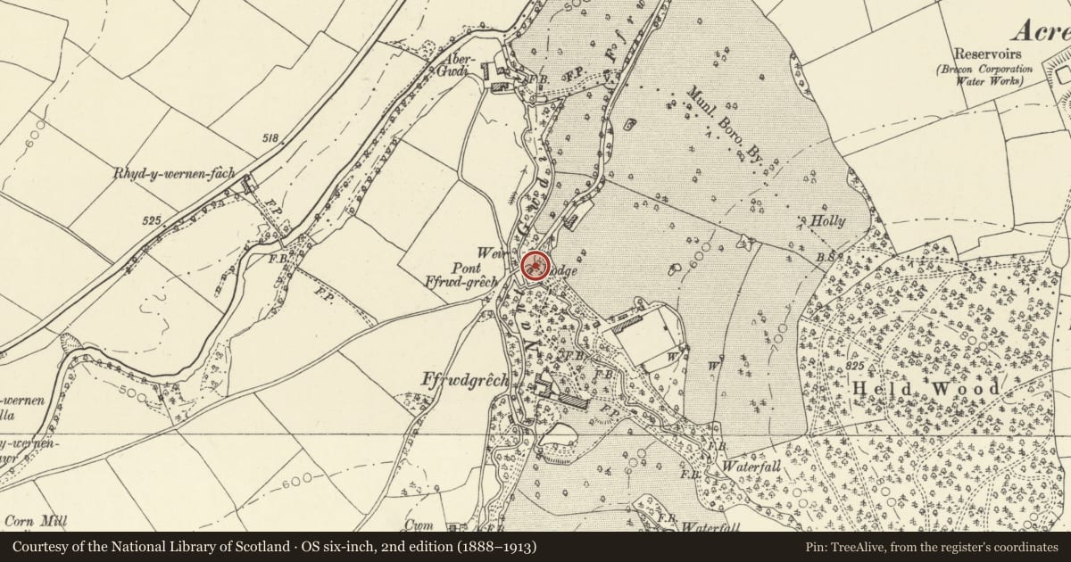
5 historical maps cover this location, the earliest the 1608 map "(13) Cambriae Typus." (David Rumsey Map Collection, Stanford Libraries).
Historical maps covering this location
- 1608 · (13) Cambriae Typus. (David Rumsey Map Collection, Stanford Libraries)
- 1636 · Cornubia : Devonia, Somersetus, Dorcestria, Wiltonia, Glocestria ... (David Rumsey Map Collection, Stanford Libraries)
- 1856 · 42. Brecon. (David Rumsey Map Collection, Stanford Libraries)
- 1898 · 213 Brecon (Hills) (David Rumsey Map Collection, Stanford Libraries)
- 1901 · Sheet 14. (David Rumsey Map Collection, Stanford Libraries)
Cadw's description
Location
Situated just N of The Lodge, with S railings curving in front of The Lodge.
History
Mid to later C19 stone gatepiers, low curved walls and low iron railings at entrance to drive to Ffrwdgrech.
Exterior
Two stone gatepiers of cut red sandstone with pedestal, shaft divided by three raised bands and a centre raised strip on each face, fluted frieze, cornice, and big grey ashlar cap with acroterial corner ornament and concave curves to flat top. Rock-faced red rubble low walls ramped down each side, with grey stone coping and low plain iron rails.
Reason for designation
Included as entrance gates to the listed country house, and for group value with The Lodge.
Nearby in the register
- The Lodge, FfrwdgrechDomesticunder 1 mi
- Stable Block at FfrwdgrechDomesticunder 1 mi
- Enclosing walls of Walled Garden at FfrwdgrechAgriculture and Subsistenceunder 1 mi
- Ffrwdgrech HouseDomesticunder 1 mi
Other entries of the same register within about three miles of this one, by straight line.