Cof Cymru: National Historic Assets of Wales · Wales
Cilwych
Glyn Tarell, Powys, Wales
A Grade II listed building in Llanspyddid, Brecon, Glyn Tarell, Powys, designated on 22 June 2005.
The record
- Designation
- Listed building, Grade II
- Broad class
- Domestic
- Date of designation
- 22 June 2005
- Locality
- Llanspyddid
- Town
- Brecon
- Community
- Glyn Tarell
- Unitary authority
- Powys
- Country
- Wales
- Coordinates
- 51.93901, -3.44962
- Cadw reference
- 84501
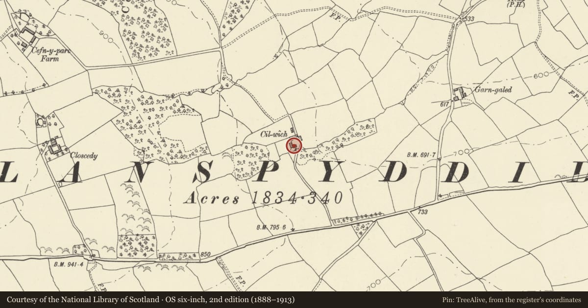
Slide toward Today to fade the historical sheet and see the modern map underneath.
David Rumsey Map Collection, Stanford LibrariesDavid Rumsey Map Collection, Stanford LibrariesDavid Rumsey Map Collection, Stanford LibrariesDavid Rumsey Map Collection, Stanford LibrariesDavid Rumsey Map Collection, Stanford Libraries
5 historical maps cover this location, the earliest the 1636 map "Cornubia : Devonia, Somersetus, Dorcestria, Wiltonia, Glocestria ..." (David Rumsey Map Collection, Stanford Libraries).
Historical maps covering this location
- 1636 · Cornubia : Devonia, Somersetus, Dorcestria, Wiltonia, Glocestria ... (David Rumsey Map Collection, Stanford Libraries)
- 1830 · V.3:11-15:XV. Britisches Reich. A. Kon: England. b. Frstenthum Wales: Shire: 37-40 (David Rumsey Map Collection, Stanford Libraries)
- 1856 · 42. Brecon. (David Rumsey Map Collection, Stanford Libraries)
- 1898 · 213 Brecon (Hills) (David Rumsey Map Collection, Stanford Libraries)
- 1901 · Sheet 14. (David Rumsey Map Collection, Stanford Libraries)
Cadw's description
Location
Situated on W side of long lane up to Cefn Uchaf, some 800m SW of Llanspyddid village.
History
Small C19 farmhouse, the cartshed dated 1822 with name of Thomas Bold. Occupied in 1926 by John Morgan.
Exterior
Farmhouse, whitewashed rubble stone with slate roof and brick end stacks. Small two storey three-window range offset to left, centre window blank amd C19 four-pane sashes with brick cambered heads, board door in bead-moulded frame, brick end stacks. Lean-to on LH end. Rubble outbuilding at right angles with tin roof, two doors and a window.
Interior
Not available for inspection.
Reason for designation
Included for its special interest as a small C19 farmhouse retaining regional character, of group value with the outbuildings.
Nearby in the register
- Outbuildings at CilwychAgriculture and Subsistenceunder 1 mi
- BolgoedDomesticunder 1 mi
- Dovecote at BolgoedAgriculture and Subsistenceunder 1 mi
- The Corn BarnDomesticunder 1 mi
Other entries of the same register within about three miles of this one, by straight line.