Cof Cymru: National Historic Assets of Wales · Wales
Blaengwrthyd
Glyn Tarell, Powys, Wales
A Grade II listed building in Llanilltyd, Brecon, Glyn Tarell, Powys, designated on 22 June 2005.
The record
- Designation
- Listed building, Grade II
- Broad class
- Domestic
- Date of designation
- 22 June 2005
- Locality
- Llanilltyd
- Town
- Brecon
- Community
- Glyn Tarell
- Unitary authority
- Powys
- Country
- Wales
- Coordinates
- 51.92861, -3.49693
- Cadw reference
- 84498
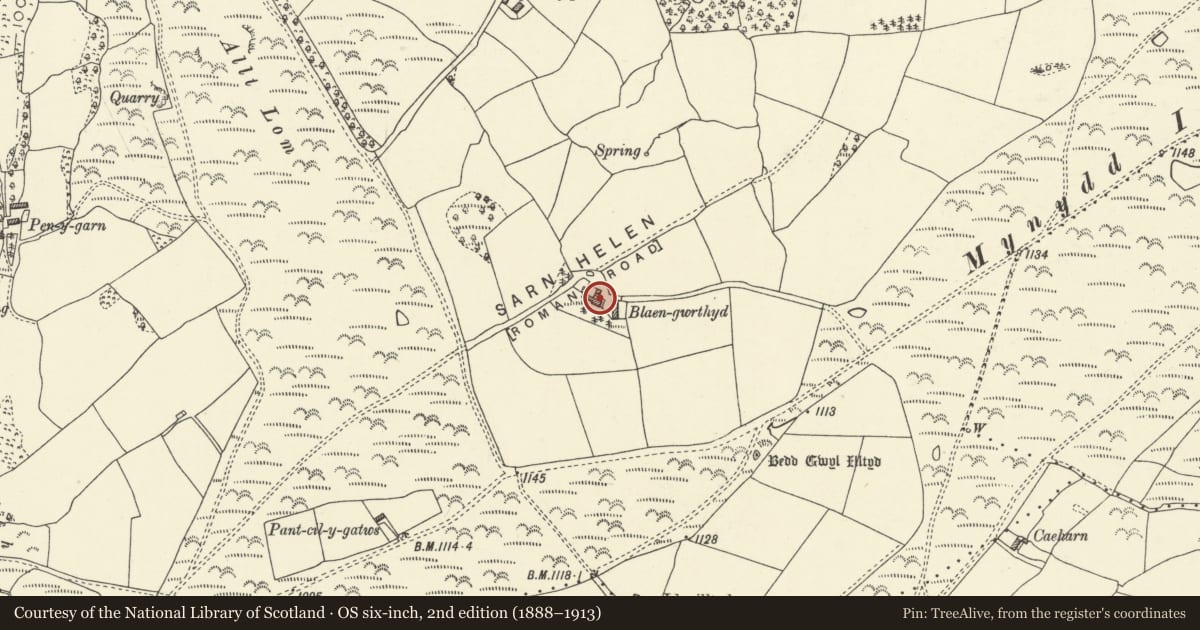
Slide toward Today to fade the historical sheet and see the modern map underneath.
David Rumsey Map Collection, Stanford LibrariesDavid Rumsey Map Collection, Stanford LibrariesDavid Rumsey Map Collection, Stanford LibrariesDavid Rumsey Map Collection, Stanford LibrariesDavid Rumsey Map Collection, Stanford Libraries
5 historical maps cover this location, the earliest the 1636 map "Cornubia : Devonia, Somersetus, Dorcestria, Wiltonia, Glocestria ..." (David Rumsey Map Collection, Stanford Libraries).
Historical maps covering this location
- 1636 · Cornubia : Devonia, Somersetus, Dorcestria, Wiltonia, Glocestria ... (David Rumsey Map Collection, Stanford Libraries)
- 1830 · V.3:11-15:XV. Britisches Reich. A. Kon: England. b. Frstenthum Wales: Shire: 37-40 (David Rumsey Map Collection, Stanford Libraries)
- 1856 · 42. Brecon. (David Rumsey Map Collection, Stanford Libraries)
- 1898 · 213 Brecon (Hills) (David Rumsey Map Collection, Stanford Libraries)
- 1901 · Sheet 14. (David Rumsey Map Collection, Stanford Libraries)
Cadw's description
Location
Situated down long track running NW of Llanilltyd Common road, some 2.4 km NW of Libanus village.
History
Farmhouse, probably C17 in origin, altered.
Exterior
Farmhouse, rubble stone with slate roof. One and a half storeys, four-window range of renewed 12-pane sashes, the upper ones breaking through the eaves with flat tops. Doorway in third bay, C20 door. Timber lintels. Exceptionally large left end external chimney-breast with several steps on the right side, two steps on the left. Lean-to to right of the chimney, possibly a bread oven. Large ruinous lofted byre attached to the right, with five doors, with oak lintels and square dips along eaves for former loft windows, the roof entirely gone.
Interior
Not available for inspection.
Reason for designation
Included for its special historic interest as a substantial upland farmhouse of regional character with very large C17 chimney.
Nearby in the register
- Roman Road on Mynydd Illtyd, North-Eastern sectionRoadunder 1 mi
- Bedd Gwyl Illtyd round cairnRound Cairnunder 1 mi
- Standing Stone on Mynydd IlltudStanding Stoneunder 1 mi
- Two Cairns on Traeth MawrCairnunder 1 mi
Other entries of the same register within about three miles of this one, by straight line.